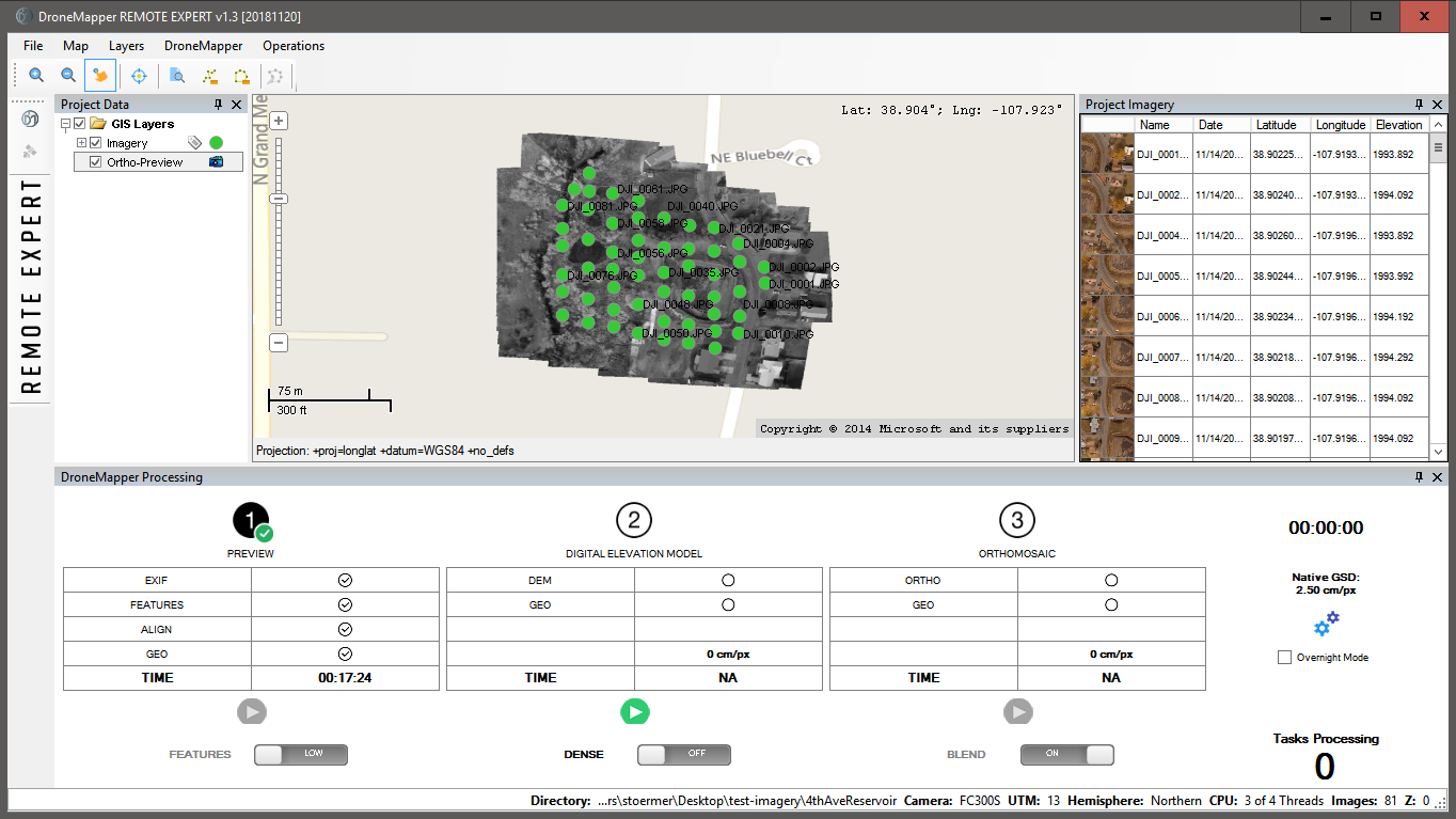
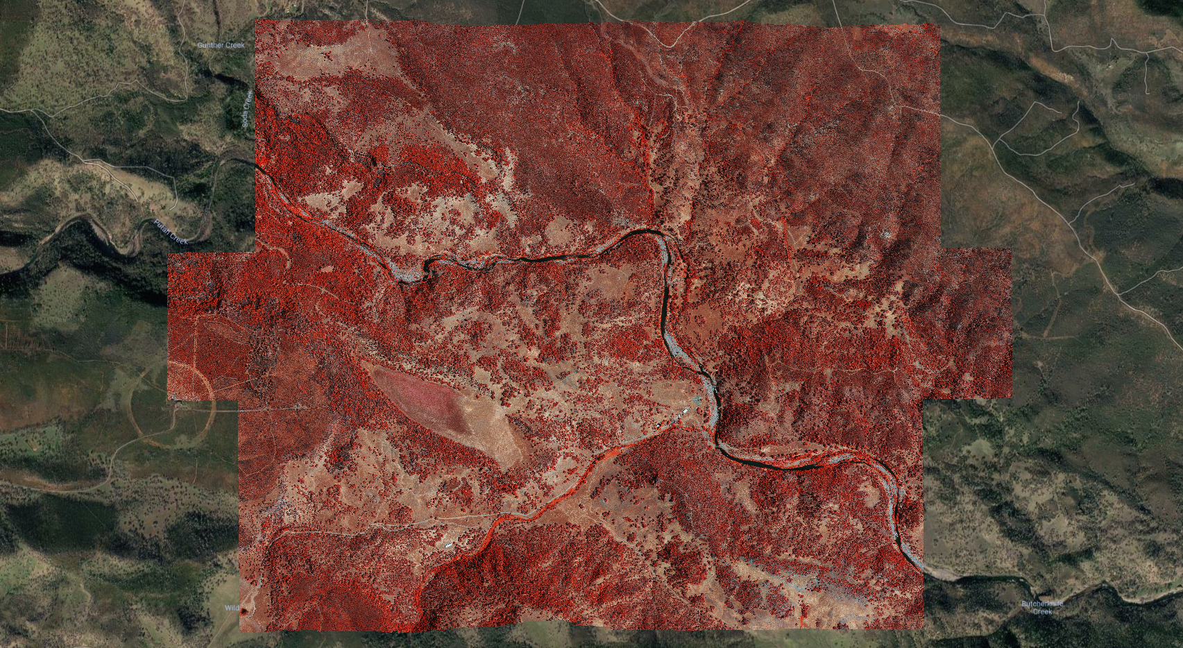
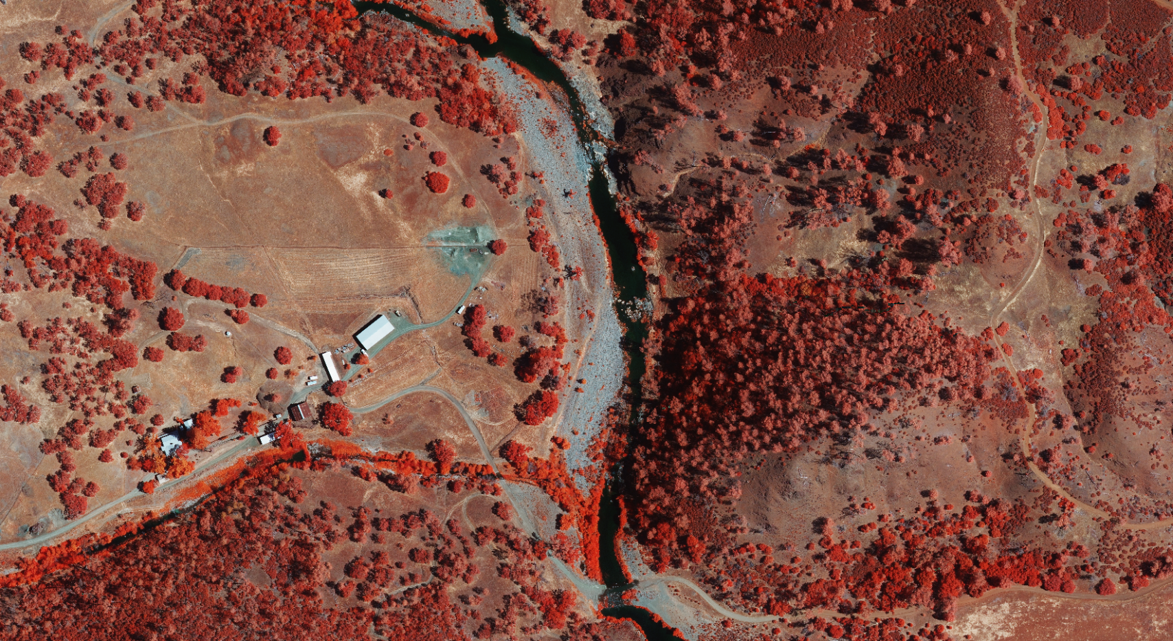
Hyperspace Challenge 2018

JP Uncategorized


DroneMapper is very pleased to announce that it has been selected as one of the ten finalists for the Hyperspace Challenge 2018 - Data Analytics competition.
Please see the following link for more details on the ten companies selected to participate:

http://hyperspacechallenge.com/announcing-finalists-for-inaugural-hyperspace-challenge/

The goal of the challenge is to connect start-up companies with cutting edge technologies and defense users in order to address and solve some of the warfighter's pressing problems. Problem statements included:
  • Remote estimation of forest density for mobility analysis,
  • Automated electrical utility change detection,
  • On-demand geo-spatial data for Target Audience Analysis,
  • Remote assessment of infrastructure conditions,
  • Rotorcraft automated identification of terrain and obstacles in visually degraded environments.
The challenge will culminate the week of November 13-16, 2018 in Albuquerque, NM. There, the companies invited and the defense users will meet, discuss the problems and formulate solutions. We hope to bring our experience and expertise in image processing to help solve these problems.

The very best from the DroneMapper team!

REMOTE EXPERT – Efficient, Affordable Desktop Photogrammetry

JP Uncategorized

KEY BENEFITS:

  • Eliminate downtime associated with cloud processing data transfers,
  • Control your DEM, ortho and point cloud processing time using selectable resolution,
  • Utilize the ortho preview function at the job site to verify imagery collection quality,
  • Generate high accuracy maps with control and built in GCP/imagery association tool,
  • Modest computing resources (4 core or more CPU, 16 GB RAM, Windows 10 OS) required to support the application.
PRICING and SUPPORT:

  • Perpetual license - $999 (no other fees ever),
  • Month-to-month license - $100/month (3 month minimum),
  • Full hands on training and support (4 hours) - $500
  • DroneMapper also provides end-to-end support including: mission planning and execution, camera set up, control placement and generation of application specific products (contours, volumetrics, planimetrics, DTMs, etc.) using GIS software (Global Mapper).
NEW FEATURES:

  • New Orthomosaic functionality, multi-threading (BETA)
  • Orthomosaic seamline feathering (BETA)
  • FULL CHANGELOG
Let us know how the DroneMapper team can help.

Drone Mapping API and Cloud Processing

JP Uncategorized

drone api

DroneMapper Cloud is an API for photogrammetric processing of aerial images. The API allows a developer to programatically interact with our Drone Mapping algorithms to generate georeferenced Digital Elevation Models, Orthomosaic Maps and Point Clouds with or without Ground Control Points (GCP).

After 7 years, we’ve retired our original web based cloud processing system and API — this is the new generation of that API. It combines our latest algorithm developments and processing experience into an enterprise focused cloud product.

API Documentation
Python Source Code Example w/ .ZIP File Download & Webhook

The API has an extensive processing dashboard and web based user interface. The UI allows an operator to upload imagery, download processed products, view results in 2D or 3D, make map based GIS measurements (Area, Distance, Slope, Volume) and more.

Request API Access

point cloud api

Drone Imagery to 3D Game Engine and Virtual Reality

JP Uncategorized

drone-imagery-blender

We’ve updated our sample page to include a Blender project with the high resolution Red Rocks virtual reality scene. We’ve also added a download link to the .OBJ, .MTL and .PLY files for import into Unity3D or other 3D rendering software. Creating real world scenes in VR quickly from drone imagery is possible using an oblique collection and our processing software.

The image above shows a 3D Textured Mesh Point Cloud converted to .OBJ format displayed in Blender. The .OBJ has an associated .MTL and .JPG file to provide the texture and material mapping.

download processed products in .OBJ
download processed products in .PLY
download Blender 3D project

We’d love to see how you use this data in your own projects! Let us know

Precision Agriculture and Calibrated gNDVI

JP Uncategorized

drones-agtech-nirdrone-gndvi-ndvindvi-plant-health-binscrop-biomass-demdrones-agtech

Here we show a set of illustrations for a crop seed research field imaged with a modified near infra-red sensor. The first image shows the scene in the infra-red and the second shows the computed scene gNDVI. The research field was outfitted with a unique set of controls. Aerial targets on the ground provided calibrated spectral reflectance as well as precise geo-spatial position. These were used over the 17 week growing period (on a weekly basis) in order to produce a meaningful temporal history of the research crop maturation.

The third image shows the automated binning of the plot average vegetation indice with color highlighting high indice (green) to low (red). The fourth image shows the 3D model of one plot prior to harvest where average crop height was computed and an estimate of biomass volume obtained.

We believe the key in using spectral imaging effectively in precision agriculture is the correlation with what the agronomists are seeing on the ground. So, high correlation coefficients are mandatory. DroneMapper can help you sort through what works for precision AG imaging. Give us a call!