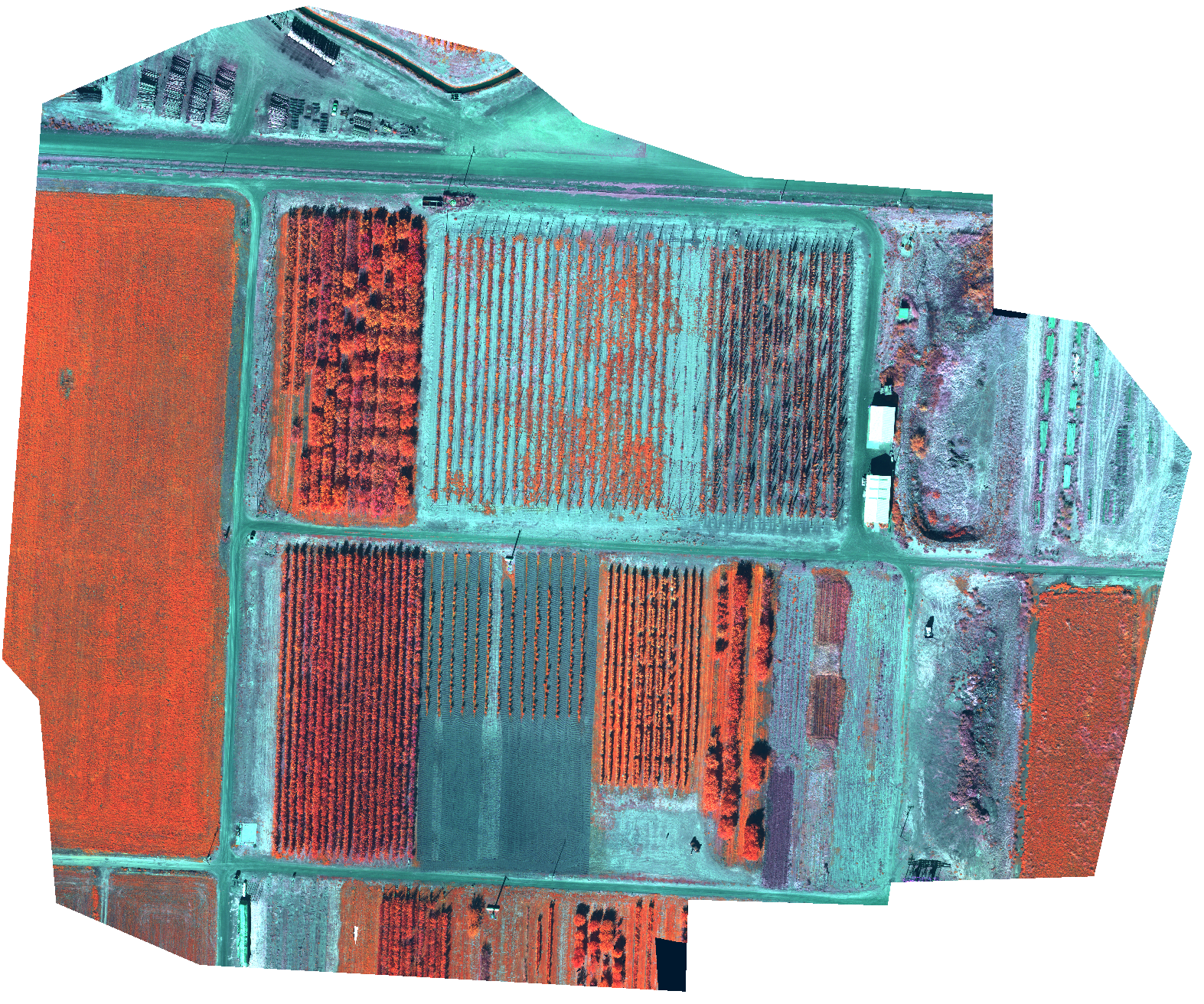
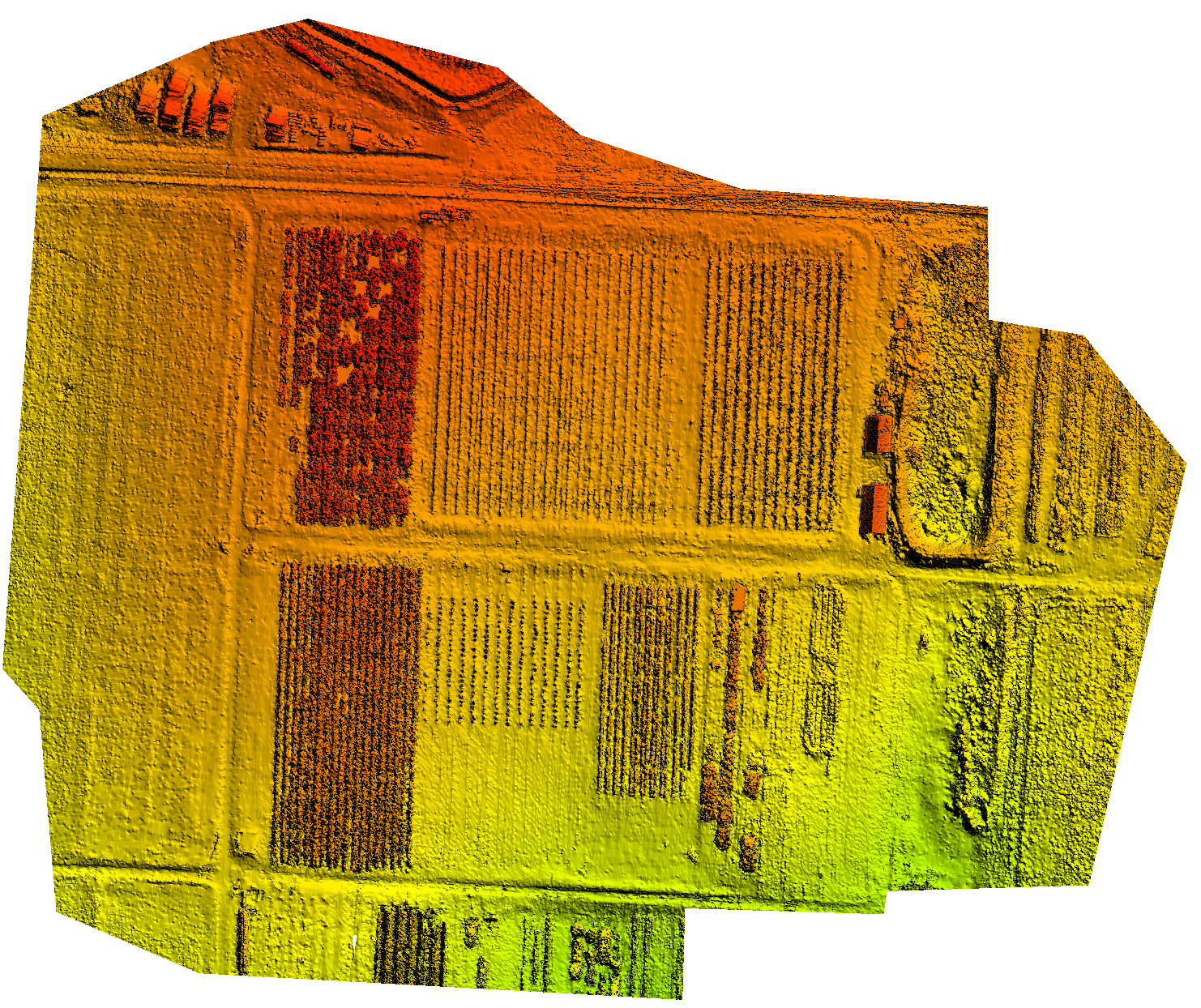
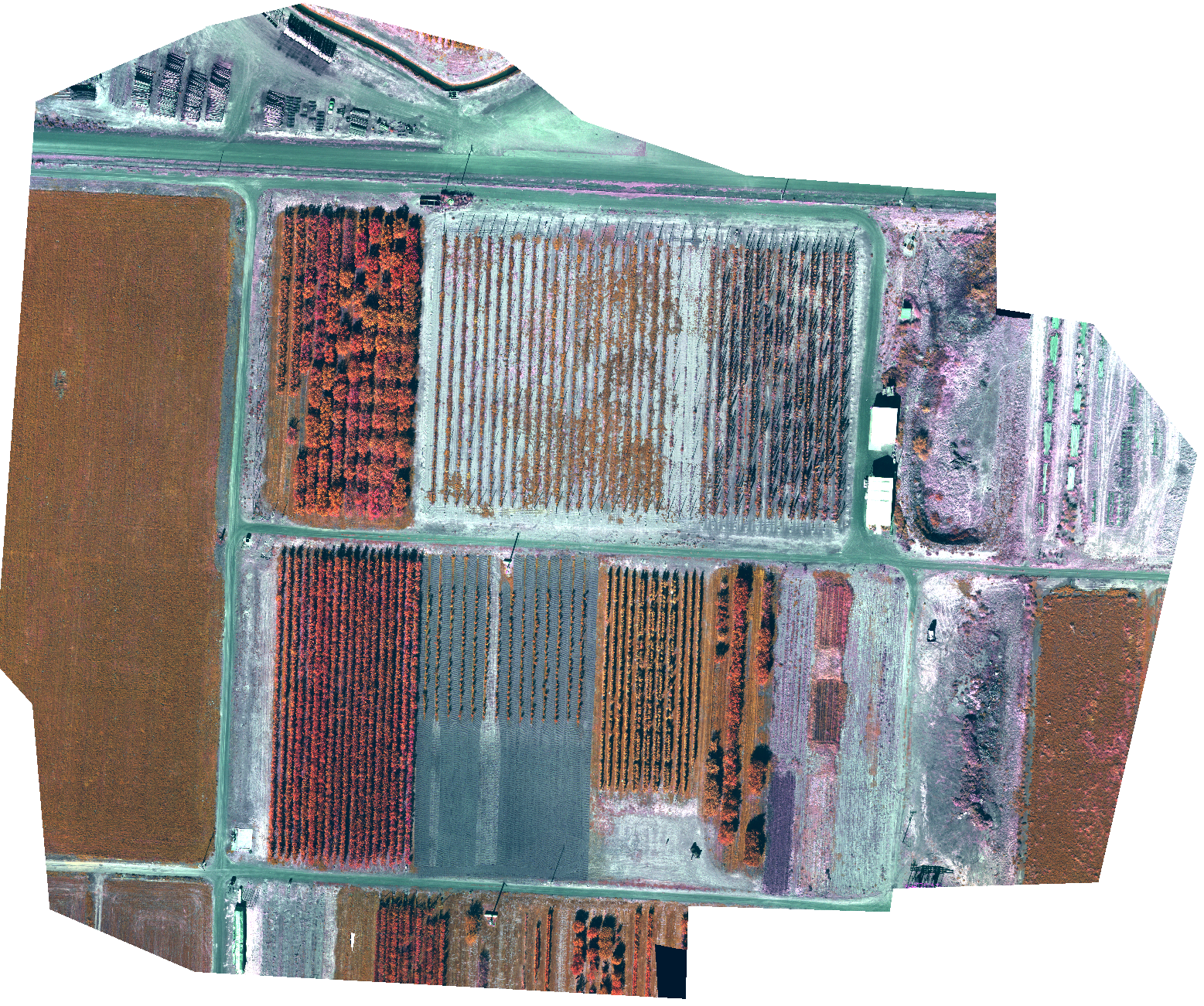
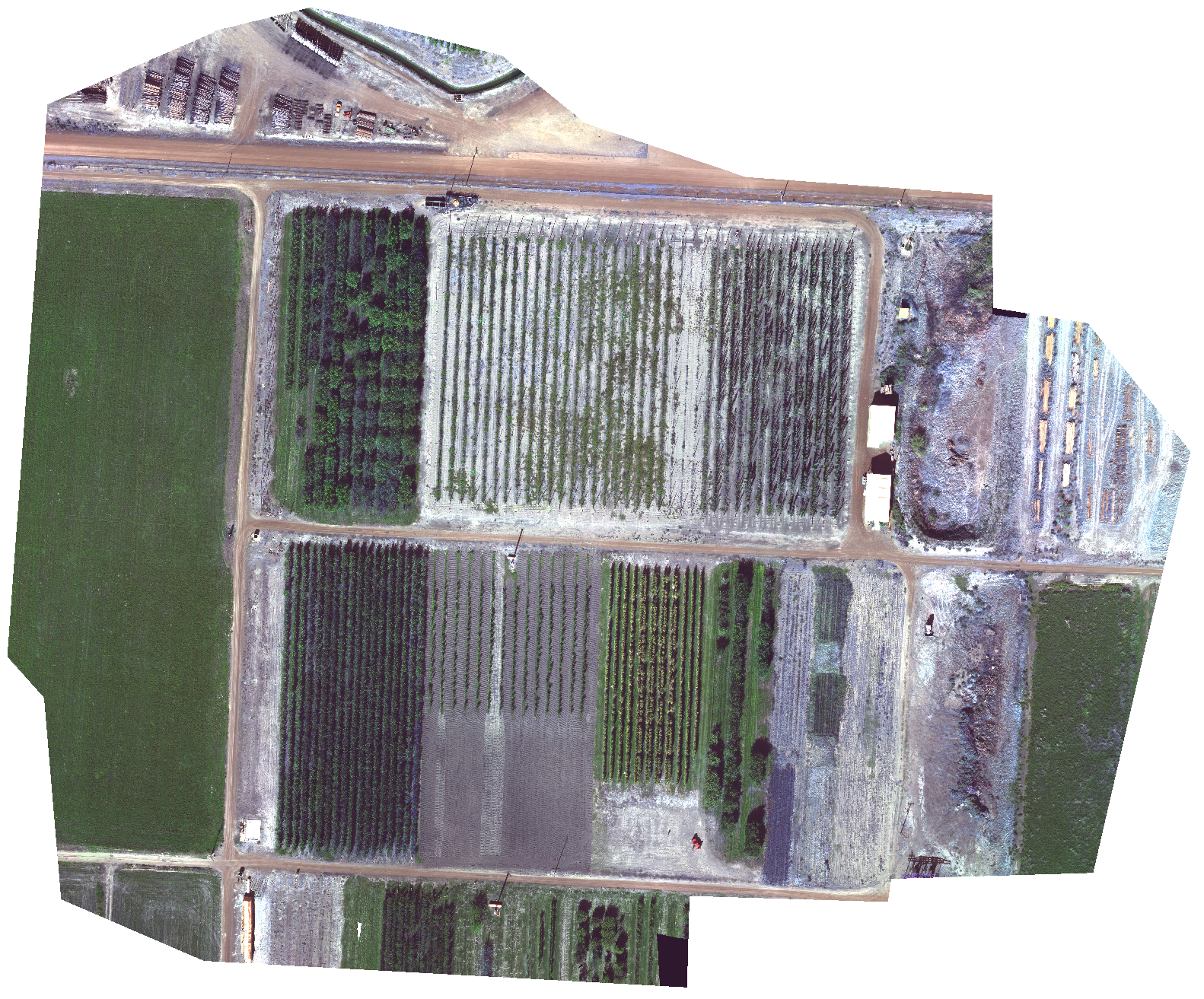
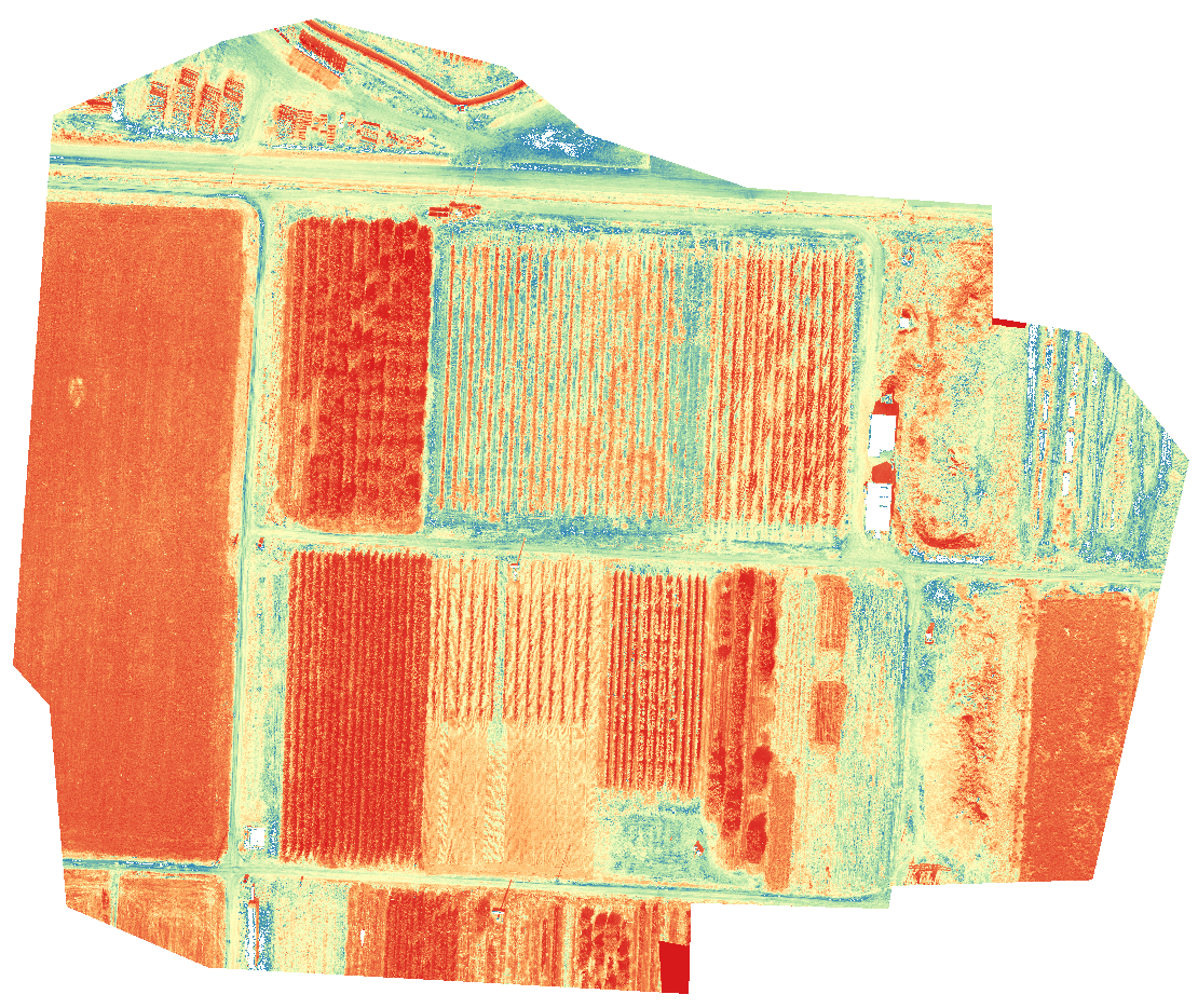
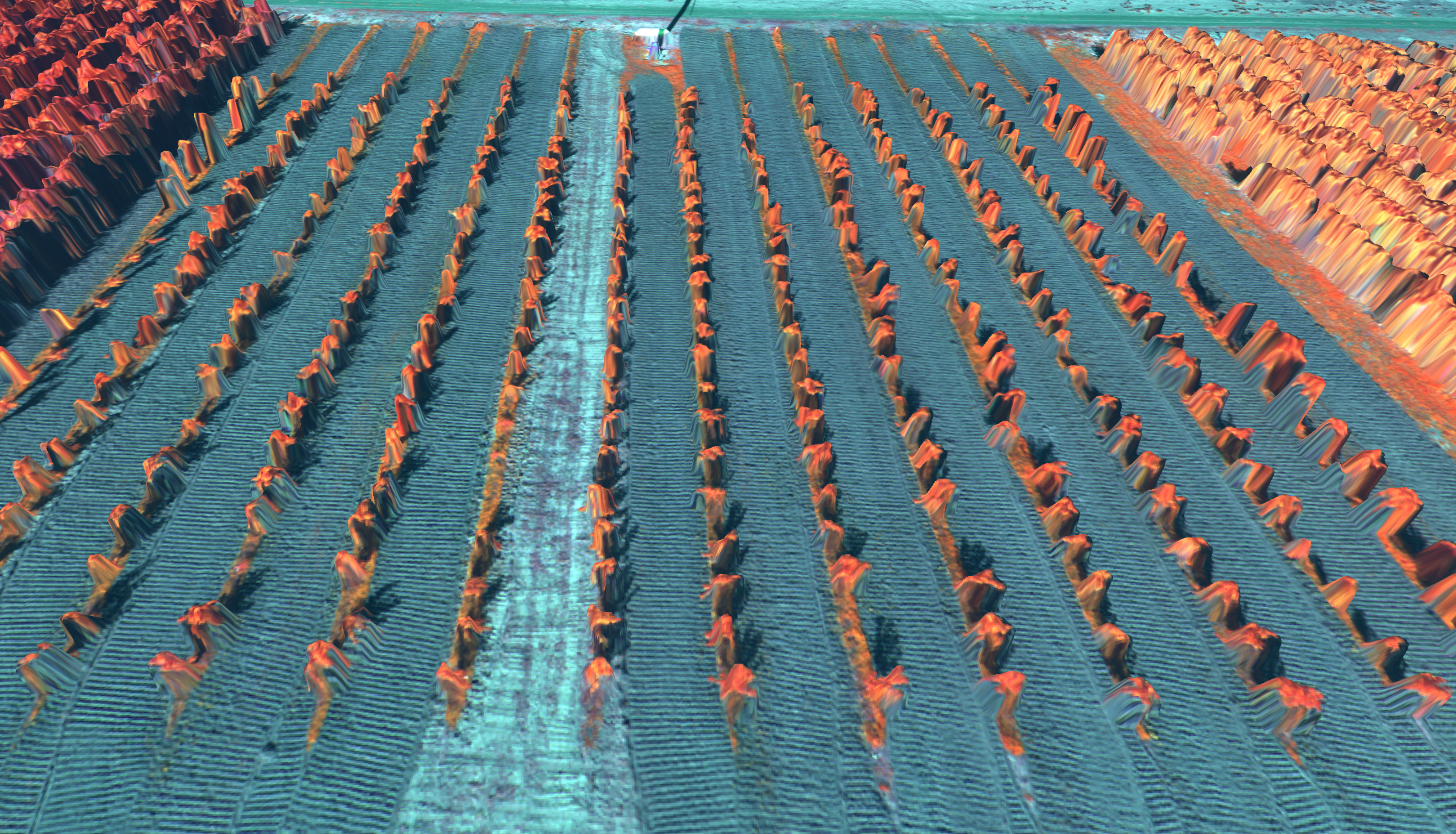
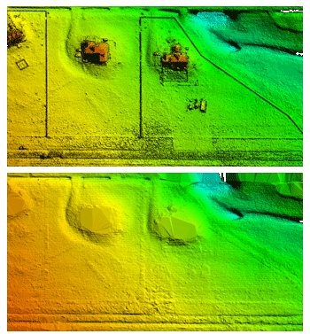
MicaSense Altum Red, Green, Blue, NIR, Rededge, Thermal
A full flight over an orchard at 120 m (~ 400 ft) with images captured with 75% overlap using the MicaSense Altum sensor. It includes captures of a calibrated reflectance panel. The original TIF outputs were stacked into a single TIF per frame using the MicaSense imageprocessing library with slight modifications by DroneMapper. The original imageprocessing library is located here. The forked library to produce DroneMapper TIF input is located here.
The resulting products are a 32bit georeferenced digital elevation model, georeferenced point cloud and a 6 band orthomosaic 16bit (Red, Green, Blue, NIR, RedEdge, Thermal).
Processed: October 2019
Notes: Georeferenced with GPS/EXIF.
Please let us or MicaSense know if you find this example useful or use them in any interesting or exciting projects!
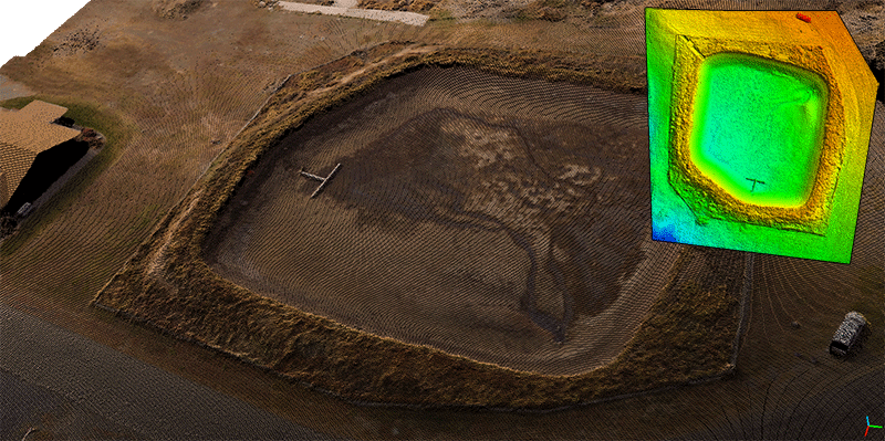
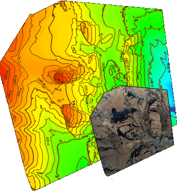
Greg 1 and 2 Reservoir Capacity Map with GCP – Grand Mesa, Colorado
DroneMapper flew Greg 1 and 2 reservoir on September 16th, 2019 using their Phantom 3 Advanced drone to collect imagery for precision digital elevation model (DEM) and orthomosaic generation of the site. GCP were surveyed with a Trimble 5800 and used during the image processing. Approximately 189 images were collected and processed via photogrammetry to yield the DEM, orthomosaic and capacity report. The original imagery is available for download along with 3D and 2D GCP data. This data set was processed using REMOTE EXPERT Drone Mapping software. Click here for more details.
Processed: September 2019
Notes: Georeferenced with GCP.
Please let us know if you find our examples useful or use them in any interesting or exciting projects!
4th Ave Reservoir Capacity Map – Cedaredge, Colorado
DroneMapper flew 4th Ave reservoir on November 14, 2017 using their Phantom 3 Advanced drone to collect imagery for precision digital elevation model (DEM) and orthomosaic generation of the site. Approximately 80 images were collected and processed via photogrammetry to yield the DEM and orthomosaic. The original imagery and processed results are available for download. This data set was processed using REMOTE EXPERT Drone Mapping software. Click here for more details.
Processed: November 2018
Notes: Georeferenced with embedded EXIF geo-tags.
download jpgs (small 48 image test subset)
Please let us know if you find our examples useful or use them in any interesting or exciting projects!
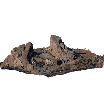
Red Rocks, Colorado – Oblique
An aerial survey performed with a Falcon UAV fixed-wing drone over Red Rocks, Colorado. The sensor is a Canon Powershot SX260HS with GPS enabled. This example data set contains 45 high resolution oblique images for 3D model and point cloud creation. The original imagery and processed results are available for download. This data set can be processed using 3D/Oblique mode in REMOTE EXPERT only. It does not process in the free RAPID version of our Drone Mapping software.
Processed: July 2017
Notes: Georeferenced with embedded EXIF geo-tags.
download jpgs
download processed products (low res)
download processed products in .OBJ (high res)
download processed products in .PLY (high res)
download Blender 3D project (high res)
Please let us know if you find our examples useful or use them in any interesting or exciting projects!
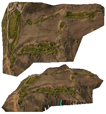
Back 9 – Cedaredge, Colorado – Golf Course
An aerial survey performed with the DJI Phantom 3 Advanced over the back 9 holes at Cedaredge golf course in Colorado. Sensor is a standard DJI P3-A FC300 at 4000×3000 pixels with 664 images collected. Original geo-tagged imagery and processed GeoTIFF products available for download.
Processed: May 2016
Notes: Georeferenced with embedded EXIF geo-tags.
download jpgs
download geotiffs
Please let us know if you find our examples useful or use them in any interesting or exciting projects!
Adobe Buttes – Delta, Colorado
Two aerial survey's performed with the DJI Phantom 3 Advanced over the Adobe Buttes near Delta, Colorado. The two flights have a large amount of overlap and the original imagery for both flights is provided for download. The imagery was collected at roughly 5cm/px GSD and covers a total area of 0.8 km sq. During this R&D mission, the DroneMapper team completed various ground control point target testing with our geoBits.io system. Sensor is a standard DJI P3-A FC300 at 4000×3000 pixels with 531 images collected between the two flights.

Processed: May 2016
Notes: Georeferenced with embedded EXIF geo-tags. No surveyed GCP, geoBits.io target testing.
download jpgs flight 1
download jpgs flight 2
download geotiffs flight 1
download geotiffs flight 2
download geotiffs flight 1 & 2 as one scene
Please let us know if you find our examples useful or use them in any interesting or exciting projects!
DTM / Bare Earth Terrain Generation – Watkins, Colorado
An aerial survey performed in Watkins, Colorado at 6.6 cm GSD with a Canon Power Shot SX260HS. For this example a DTM (bare earth terrain model) was also generated.
Processed: Dec. 2015
Notes: Georeferenced with embedded EXIF geo-tags. No ground control points (GCP).
download dtm kmz
download dtm geotiff
download dem geotiff
download ortho & point cloud
Please let us know if you find our examples useful or use them in any interesting or exciting projects!
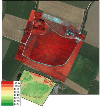
Precision Agriculture R-G-NIR, Switzerland
An aerial survey performed in Switzerland at 3.7 cm GSD with a Canon Power Shot S110 that captures RED, GREEN, NIR wavelength. The original imagery is available at the Pix4D example page in 16 bit TIFF format. Roughly 101 images at 4048×3038 pixels were processed into an Orthomosaic, NDVI, and additional NDVI layers.
Processed: Apr. 2015
Notes: Georeferenced with embedded EXIF geo-tags. No ground control points (GCP).
download management zone shapefile
download orthomosaic kmz
download ndvi kmz
download ndvi legend
download orthomosaic geotiff
download ndvi geotiff
download jps
Please let us know if you find our examples useful or use them in any interesting or exciting projects!
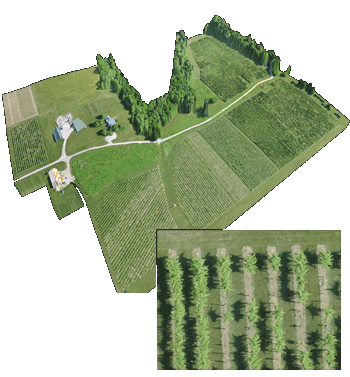
Precision Agriculture R-G-B, Indianapolis USA
An aerial survey performed with Precision Hawk UAV over an agriculture farm near Indianapolis. The data set consisted of roughly 644 geo-tagged images from a Canon 260 at 4 cm per pixel GSD. This is a small sample of the larger 2 km2 area of interest.
Processed: March 2014
Notes: Georeferenced with embedded EXIF geo-tags. No ground control points (GCP).
download orthomosaic kmz
download dem
download ortho
Please let us know if you find our examples useful or use them in any interesting or exciting projects!
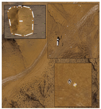
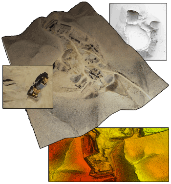
BLM Gravel Pit, Colorado
An aerial survey performed with Falcon UAV over a BLM gravel pit in Western Colorado. The data set consisted of roughly 240 geo-tagged images from a Canon 260 at 3.2 cm per pixel GSD. This example is useful to illustrate volumetric calculations, topographical surveys, contour line generation and more.
Processed: 2013
Notes: Georeferenced with embedded EXIF geo-tags. No ground control points (GCP).
download orthomosaic kmz
download point cloud
download orthomosaic
download dem
download dsm
Please let us know if you find our examples useful or use them in any interesting or exciting projects!
Red Rocks Amphitheater, Colorado
Red Rocks Amphitheater, Colorado. At 6,450 feet above sea level, Red Rocks Park is a unique transitional zone where the Great Plains meet the Rocky Mountains. Red Rocks Amphitheatre is a geological phenomenon – the only naturally-occurring, acoustically perfect amphitheatre in the world. Some of the rock formations in Red Rocks slope as much as 90 degrees, while others tilt backwards. The southern monolith, that bears resemblance to a ship, is named "Ship Rock." On the opposite side of the Amphitheatre stands "Creation Rock." Both of the monoliths are taller than Niagara Falls, and the Red Rocks Amphitheatre was once listed as among the Seven Wonders of the World. Processed at ~6.6 cm / px GSD, the Orthomosaic, Digital Elevation Model (DEM), Digital Surface Model (DSM) and Point Clouds are composed of 223 geo-tagged images from a Falcon UAV.
Processed: Jan. 2013
Notes: Georeferenced with embedded EXIF geo-tags. No ground control points (GCP).
download orthomosaic kmz
download point cloud
download orthomosaic
download dem
download dsm
Please let us know if you find our examples useful or use them in any interesting or exciting projects!
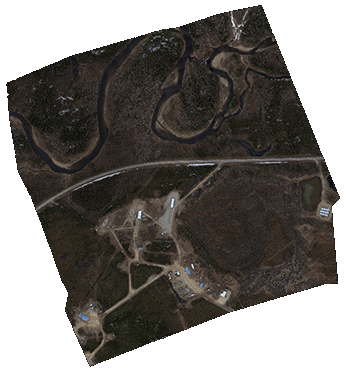
The Poker Flats Research Range, Alaska
Poker Flats provided by Gatewing/Trimble. Data collection was processed at a native ground sample distance (GSD) of 4.4 cm per pixel. The Orthomosaic, Digital Elevation Model (DEM) and Digital Surface Model (DSM) are composed of 602 geo-tagged images from X100 UAV.
Processed: Oct. 2012
Notes: Georeferenced with embedded EXIF geo-tags. No ground control points (GCP).
download jpgs
download orthomosaic
download dem
download dsm
Please let us know if you find our examples useful or use them in any interesting or exciting projects!