Pierre Stoermer, CEO – DroneMapper.com
DroneMapper flew 4th Ave reservoir on November 14, 2017 using their Phantom 3 drone to collect imagery for precision digital elevation model (DEM) and orthomosaic generation of the site. Approximately 80 images were collected and processed via photogrammetry to yield the DEM and orthomosaic. Figure 1 illustrates the orthomosaic of 4th Ave reservoir, a few holding ponds and a small portion of Surface Creek to the northwest.
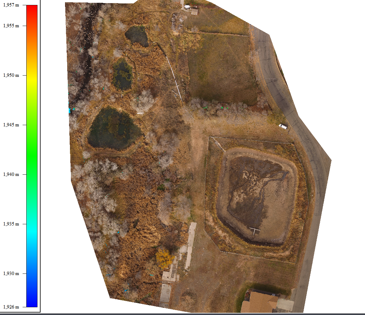
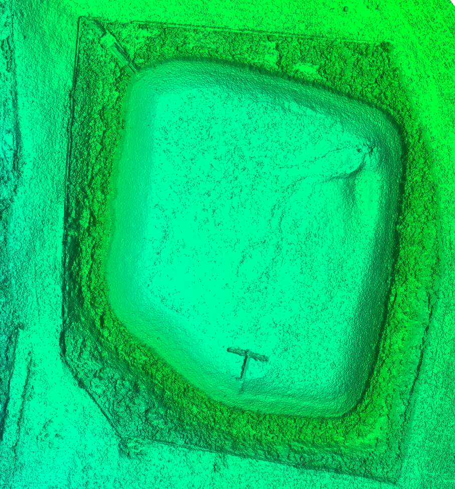
Figure 2 illustrates the DEM (zoomed in) constructed for the reservoir.
DroneMapper’s REMOTE EXPERT Windows application was used to generate the DEM and ortho from the image collection. Screenshots of the DEM and orthomosaic follow. REMOTE EXPERT generated the data products within one hour on our laptop, allowing processing in the field and mission verification prior to pack-up.
Figure 3 illustrates the contours generated for the DEM. The blue highlighted contour represents the reservoir’s maximum capacity. Global Mapper was then used to construct 1’ interval elevation contours as shown below:
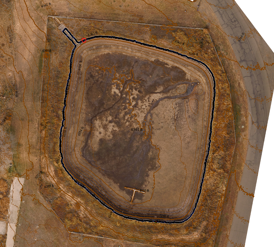
The maximum capacity was calculated to be between 3 and 3.17 acre-feet. This is equivalent to approximately 1,000,000 gallons of water.
Phantom 3 Advanced Firmware: 1.8.10
MapPilot Version: 1.5.0 build 031916
DJI Go App Version: 2.8.6
Ipad Mini4 iOS Version: 9.3.3
Remote Expert Version: v0.8 b20170829-842 x64
Global Mapper Version: v19
Thank you, The DroneMapper Team