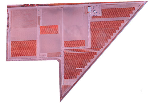
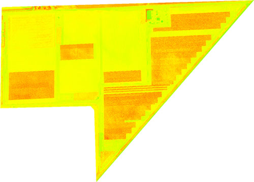
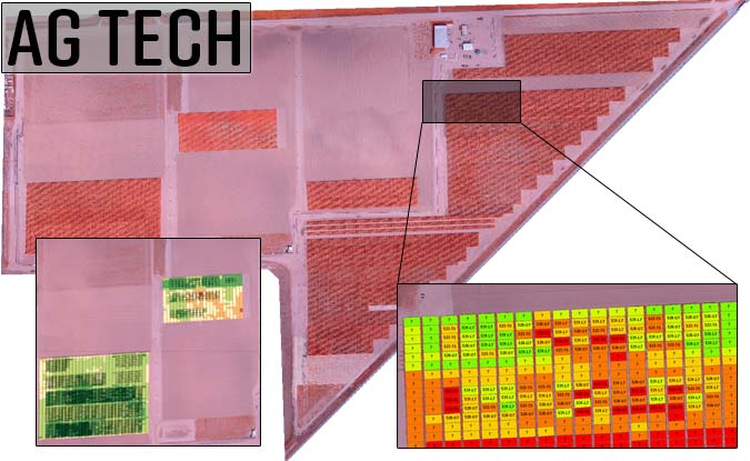
Here we show a set of illustrations for a crop seed research field imaged with a modified near infra-red sensor. The first image shows the scene in the infra-red and the second shows the computed scene gNDVI. The research field was outfitted with a unique set of controls. Aerial targets on the ground provided calibrated spectral reflectance as well as precise geo-spatial position. These were used over the 17 week growing period (on a weekly basis) in order to produce a meaningful temporal history of the research crop maturation.
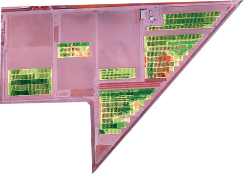
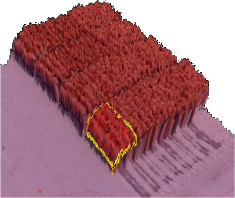
The third image shows the automated binning of the plot average vegetation indice with color highlighting high indice (green) to low (red). The fourth image shows the 3D model of one plot prior to harvest where average crop height was computed and an estimate of biomass volume obtained.
We believe the key in using spectral imaging effectively in precision agriculture is the correlation with what the agronomists are seeing on the ground. So, high correlation coefficients are mandatory. DroneMapper can help you sort through what works for precision AG imaging. Give us a call!