DroneMapper Relocation Completed

JP Uncategorized


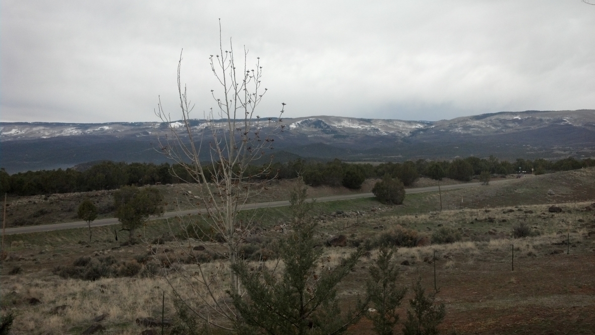
(Office View from 6700 ft Elevation of Grand Mesa, Colorado)

DroneMapper has completed its relocation to the beautiful Grand Mesa. The last few weeks were a little hectic with the move and setting up the infrastructure for processing services. We thank all of you for your patience during the relocation. Our new office is located on Main Street, within the Columbine Mall, in Delta, CO. Please give us a call and stop by whenever your travels bring you to the Western Slope of Colorado.

  • We have made a few policy changes on how we will conduct our services for the future:
  • For large area (> 50 sq. Km) collections at lower resolutions (> 20 cm GSD) our pricing has been discounted to $10/sq. Km,
  • Smaller area collects at higher resolutions will start at $20/sq. Km and could go higher depending on sensor format and actual GSD used for processing,
  • For the last year we have taken the risk of performing processing prior to invoicing for services. That policy has been changed to payment prior to processing. As has always been the case, should you be dis-satisfied with our results (submitted in writing) your payment will be refunded.
  • For our contract clients there will be no change to our current working relationship.

We look forward to serving your image processing needs!
With best regards, JP & Pierre, DroneMapper.com


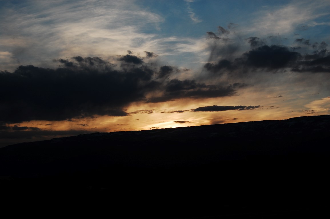
(Sunset in Paradise)

DroneMapper Corporate Relocation

JP Uncategorized

February 22nd, 2013

DroneMapper will be moving its corporate office from Boulder, CO to the Grand Mesa, CO on or before March 22, 2013. To all of our valued clients – we will be making all efforts possible to relocate quickly and minimize service disruption. If you have image processing requirements during this next month that needs immediate attention please contact us as soon as you know of them. In the meantime, please check our news section for updates on the actual timing of the relocation. Thank you!

DroneMapper Signs Multi-Year Contract With The State of Utah

JP Uncategorized

January 28th, 2013


We are very pleased to announce that the Utah Department of Agriculture and Food (UDAF) has contracted with DroneMapper to provide imagery processing services for the next 5 years.  UDAF collects high resolution imagery for use in conservation planning and management of natural resources. As an example, DroneMapper recently processed an imagery set as part of Utah’s effort to mitigate salinity migration into the Colorado River.

UDAF conducted an evaluation of other service providers like DroneMapper and standalone imagery processing software packages, and found that DroneMapper meets their needs in terms of quality and affordability.

We look forward to providing services to the State of Utah and its researchers to keep its lands sustainable and productive. For more information on UDAF, please visit: http://ag.utah.gov/

Red Rocks Amphitheater Photogrammetry Mission with Falcon UAV

JP Uncategorized

January 18th, 2013

Amazing day in Colorado for a photogrammetry mission with Falcon UAV over Red Rocks Amphitheater, Colorado. At 6,450 feet above sea level, Red Rocks Park is a unique transitional zone where the Great Plains meet the Rocky Mountains. Red Rocks Amphitheatre is a geological phenomenon – the only naturally-occurring, acoustically perfect amphitheatre in the world. Some of the rock formations in Red Rocks slope as much as 90 degrees, while others tilt backwards. The southern monolith, that bears resemblance to a ship, is named "Ship Rock." On the opposite side of the Amphitheatre stands "Creation Rock." Both of the monoliths are taller than Niagara Falls, and the Red Rocks Amphitheatre was once listed as among the Seven Wonders of the World.

Falcon flew late morning of January 18, 2013 and collected more than 600 photos in a little over 30 minutes. We shot a combination of nadir looking and oblique photos. One of the obliques, shown above looking to the west – southwest, gives the viewer a feel of the scale of the two monoliths that frame the amphitheatre. The nadir images were processed at a resolution of 6.6 cm and the resultant geo-referenced orthomosaic, digital elevation model and 3-D model are also shown below. If you are interested in learning more on how to precisely map difficult terrain please do not hesitate to contact either falcon-uav.com or dronemapper.com

Pinery Geospatial Accuracy Update

JP Uncategorized

January 2, 2013

In November 2012 we described the results from an UAV survey (courtesy of Falcon-UAV) conducted over the Pinery Country Club where an area of > 1 square mile was mapped at 6.7 cm resolution. We had access to a set of precision ground control points (GCPs) (courtesy of CompassData, Inc.). The ortho below shows the Pinery area surveyed with a set of ground control used for subsequent data processing and quality control verification. The GCPs circled in red show the original 6 points used in the processing of the DEM with the other 9 used for QA verification. We had a chance to re-process this data with 9 GCPs for the DEM. The additional 3 points selected are shown circled in yellow. The table below illustrates the absolute geo-spatial accuracy improvement by the addition of GCPs.


The table compares the results of the new processing with 9 GCPs (pink or orange) against the former – 6 GCPs (light green). The evaluation conditions are 1) RMSE error in GCPs (gnd control) that were used for processing, 2) RMSE error in GCPs (QA check) that were not used for processing and 3) RMSE error for all 15 GCPs. There was a significant improvement (~ 3 X) in absolute elevation error. The easting accuracy also improved by about 50%.