January 2, 2013
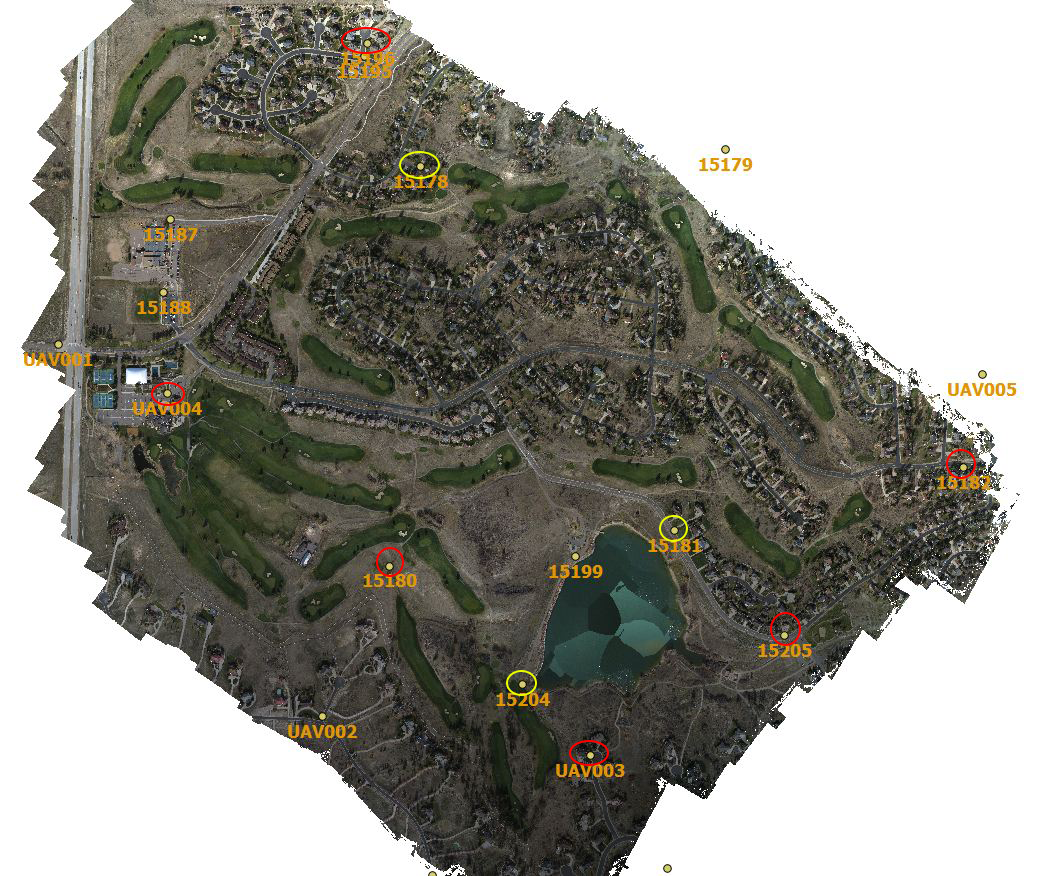
In November 2012 we described the results from an UAV survey (courtesy of Falcon-UAV) conducted over the Pinery Country Club where an area of > 1 square mile was mapped at 6.7 cm resolution. We had access to a set of precision ground control points (GCPs) (courtesy of CompassData, Inc.). The ortho below shows the Pinery area surveyed with a set of ground control used for subsequent data processing and quality control verification. The GCPs circled in red show the original 6 points used in the processing of the DEM with the other 9 used for QA verification. We had a chance to re-process this data with 9 GCPs for the DEM. The additional 3 points selected are shown circled in yellow. The table below illustrates the absolute geo-spatial accuracy improvement by the addition of GCPs.
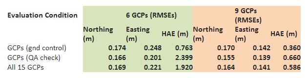
The table compares the results of the new processing with 9 GCPs (pink or orange) against the former – 6 GCPs (light green). The evaluation conditions are 1) RMSE error in GCPs (gnd control) that were used for processing, 2) RMSE error in GCPs (QA check) that were not used for processing and 3) RMSE error for all 15 GCPs. There was a significant improvement (~ 3 X) in absolute elevation error. The easting accuracy also improved by about 50%.