We’ve added orthomosaic seamline detection and blending enhancement algorithms to the DroneMapper processing service. The routines have been tested on NIR imagery and RGB visible imagery with great results. These improvements significantly improve the overall visual appeal of our orthomosaic products without compromising the resulting geo-referenced NDVI or radiometrics. Please contact DN2K, AgEagle or DroneMapper for your precision agriculture needs. The NIR data set below is courtesy of DN2K and AgEagle.
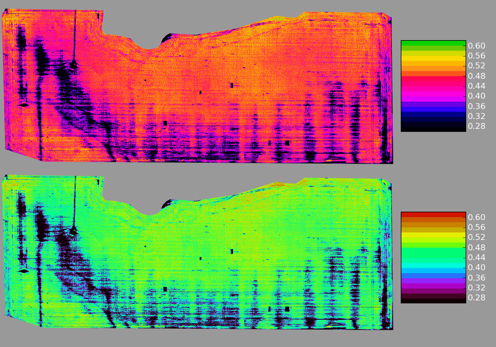
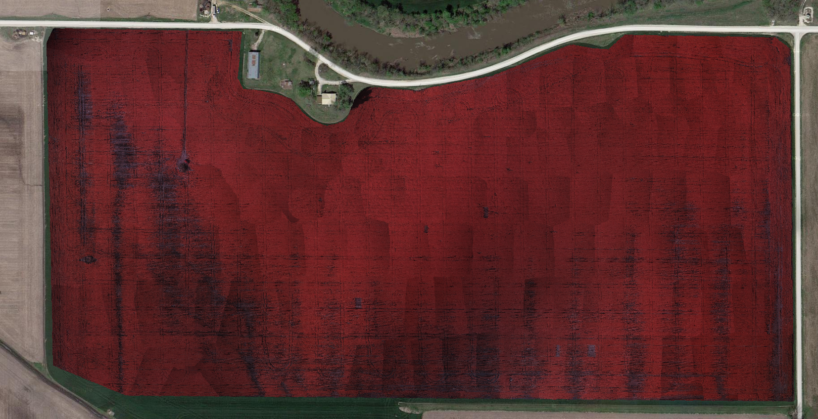
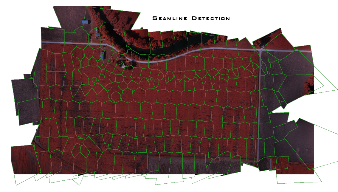
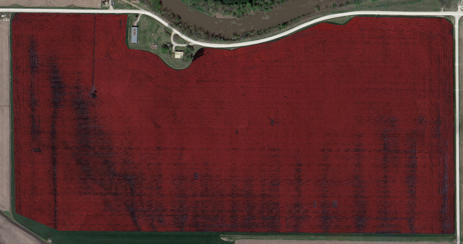
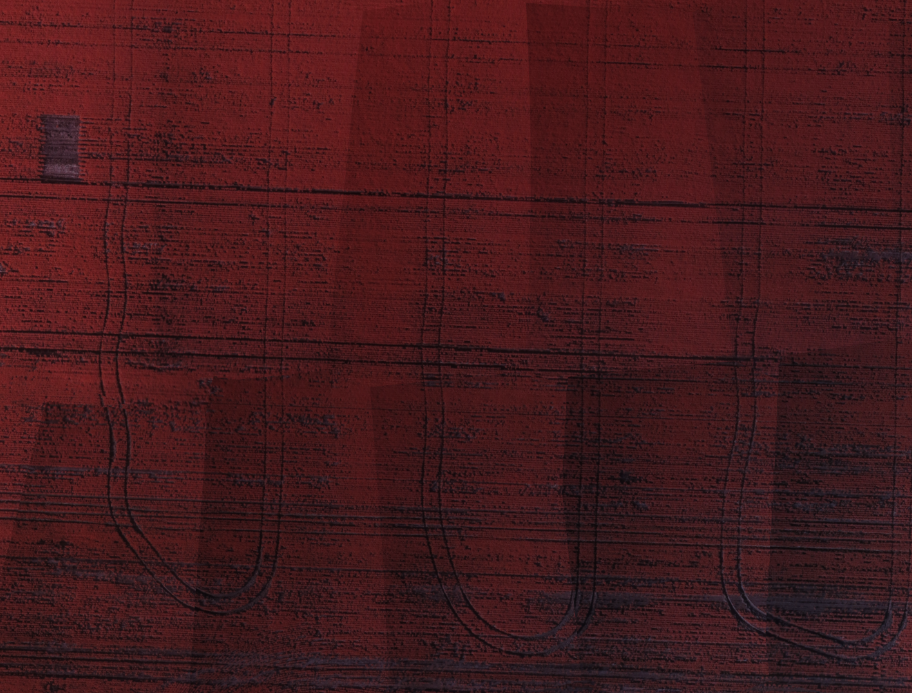
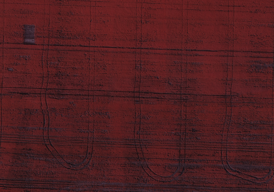
DroneMapper has implemented blending and smoothing algorithms in order to eliminate or at least significantly minimize the appearance of seamlines in orthomosaics. Figure 1) shows a field imaged in the NIR with seamlines apparent throughout the field. A seamline detection algorithm was utilized to identify edges (shown in Figure 2) between processed tiles and apply a blending or feathering of the radiance at these seams. Figure 3 illustrates the result of incorporating this technique. The majority of seamlines have been significantly smoothed offering a more visually appealing scene. Figures 4 and 5 show the same area of the ortho at higher resolution before and after the technique was applied.
(Figure 1) Original Orthomosaic:
(Figure 2) Seamline detection:
(Figure 3) Orthomosaic with seamline detection and removal:
(Figure 4) Original Orthomosaic:
(Figure 5) Orthomosaic with seamline detection and removal:
Geo-Referenced Enhanced NDVI and Traditional NDVI: