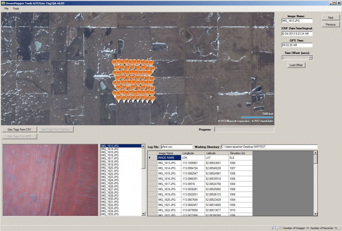
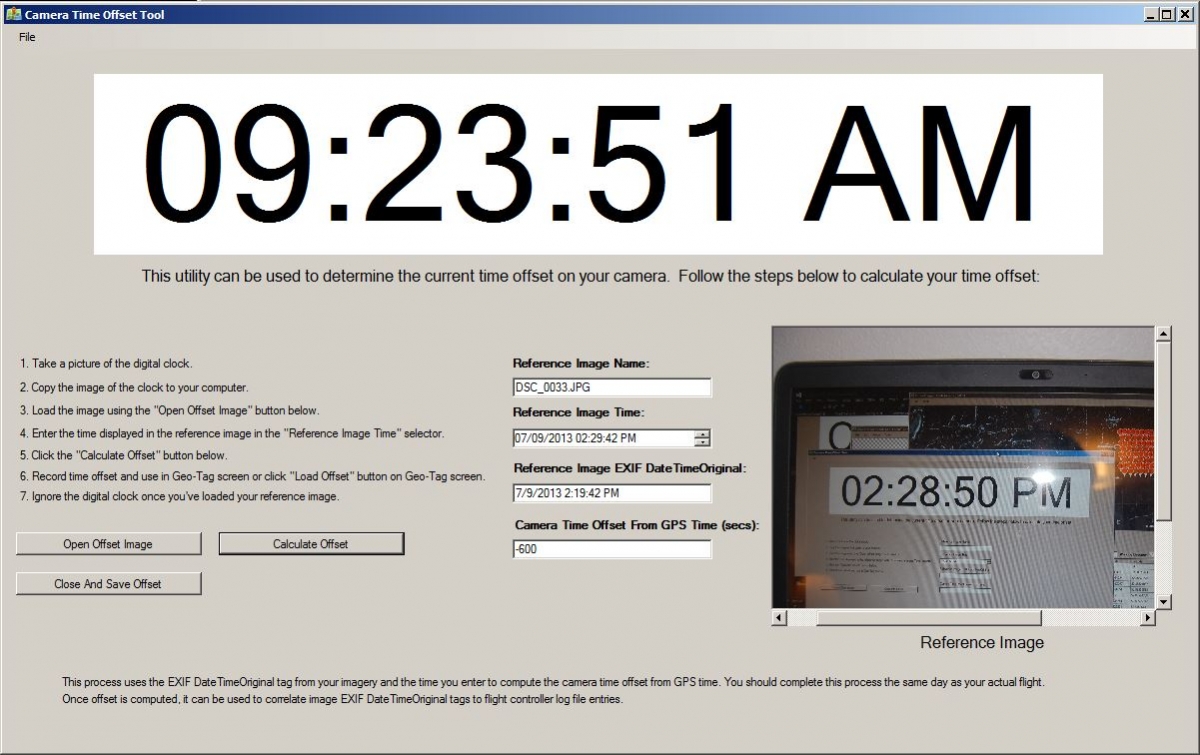
A new version of DroneMapper Tools is available. We've added a Geo-Tag tool and a camera time offset calculator. The camera time offset calculator is useful for sensors without an on-board GPS. The on-board camera GPS allows for easy syncing of image DateTimeOriginal EXIF tags to log file entries. Using the offset tool you can quickly calculate the time difference from your camera to GPS time and use this delta to apply geo-tags using tools like GeoSetter or exiftool (command line). Currently the Geo-Tag tool works with CSV files only, we plan to add more flight log controller support in the future. Once we add additional flight controller logs, the time offset that is calculated will be used to automatically geo-tag your imagery. In order to use the CSV based geo-tagging, you should generate a CSV file in the following format:
IMAGE NAME,LON,LAT,ELE
IMG_1613.JPG,-113.1009951,52.88523841,1006
IMG_1614.JPG,-113.0994724,52.88540228,1007
IMG_1615.JPG,-113.0982547,52.88524987,1008
IMG_1616.JPG,-113.0966351,52.88535518,1006
IMG_1617.JPG,-113.09516,52.88524758,1004
IMG_1618.JPG,-113.0938281,52.88525892,1008
IMG_1619.JPG,-113.0922831,52.88526133,1008
There needs to be a 1 to 1 relationship with the CSV log file and the number of images. In other words, if you have 71 images, the CSV file should have 71 data rows. 72 rows total including header. The order of the columns is important and header should be included. File extension is .csv.
If anyone has a set of imagery and corresponding flight controller logs they'd like to submit, please let us know. We will add support for these type of files.
Notes for consideration:
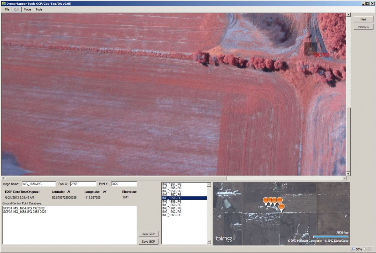
* 2D GCP Tool only accepts geo-tagged imagery.
* A new directory is created in your 'workdir' named 'Geo-Tag', this is where the newly tagged imagery is stored.
* Time Offset Tool is only useful to calculate offset at this point. Helpful for tools like GeoSetter and exiftool.
* Compiled for x64 Windows.
* Flight QA Tool will be added in the future to check imagery coverage in the field over cached Bing Maps.
2D Ground Control Point Generation Tool:
CSV Geo-Tagging Tool:
Camera Time Offset Calculator:
Download Link: http://s3.amazonaws.com/DroneMapper_US/DMT_v0.05.zip
Please let us know if you have a flight controller you'd like supported or if you have any suggestions.