Use this workflow to process aerial UAV imagery with DroneMapper and Global Mapper to create an Enhanced and Traditional NDVI. These steps assume you are working in a licensed version of REMOTE or REMOTE EXPERT. We recommend using Map Pilot or DJI GS Pro for initial data/imagery collection and flight planning.
Global Mapper: http://www.bluemarblegeo.com/index.php
MaxMax Camera: http://maxmax.com
DroneMapper: https://dronemapper.com/software_downloads
- Open DroneMapper and navigate to a NIR imagery collection
- Navigate to the "DroneMapper Processing" tab and click the settings icon, enable NDVI creation, start the processing
- Once processing has completed for the DEM and Orthomosaic, the Enhanced and Traditional NDVI files will be created.
For more information on NDVI formula's please visit the following: http://www.maxmax.com/endvi.htm
The traditional NDVI formula uses the blue channel for the NIR because the Kodak had created a special kind of color infrared film where the blue crystals could respond to blue or infrared light while the red and green crystals only responded to visible light. By using a visible blue light blocking filter, the user could capture an image where Blue = NIR, Green = Visible Green, and Red = Visible Red. The red channel was used instead of the green since the green channel would also reflect light while the red channel absorbed light when taking pictures of plants. The key is that you need a NIR plant reflective channel and a visible plant absorption channel.
Digital cameras respond different than film. The main thing to understand is that you want the camera to have near infrared and visible bands in separate channels. Once you have the NIR isolated in a color channel, you can perform NDVI type measurements. With our NDVI cameras, the blue and green channels see visible light while the red sees the NIR. Thus, the NDVI formula can be re-written for these cameras as:
The blue channel for our NDVI can be used equally as well for the visible absorption channel as the Kodak film used the red as the visible absorption channel.
We have found that you can get even better results if you use the red and green as the reflective channels while using the blue as the absorption channel. Remember that a normal healthy plant will reflect both visible green light and NIR light. We can improve on the NDVI formula for these cameras by changing the formula:
This ENDVI formula sums the NIR and Green channels together for the reflective channel. The Blue channel is multiplied by two to compensate for the NIR and Green channels being summed together.
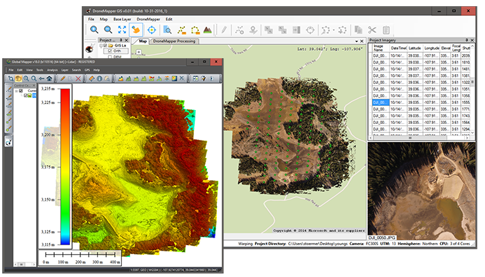
You can new view the ENDVI or NDVI in Global Mapper to perform zonal statistics/pixel calculations/etc
![[?IMG]](https://lh3.googleusercontent.com/y8dEp9lIg80aOE7BuzV5S-unyxfG8DV6FSoBx17YuD2mbOaltI2Y6NCwWVo1ZgR2d-00HaTIOwusL6kz1A6lduHUihjlqGucKea_dLcwzSX-B1a7QmUoDmjzSv0OqUuksN1BvsvQ)