RAPID
Note: If you are having trouble installing the software after recent Windows 10 updates, please run the installer as Administrator and choose “Run anyway”.
Screenshot of Run Settings
or
Disable the Windows Defender SmartScreen checks for “Unauthorized Apps” before running the installer.
Screenshot of SmartScreen Settings
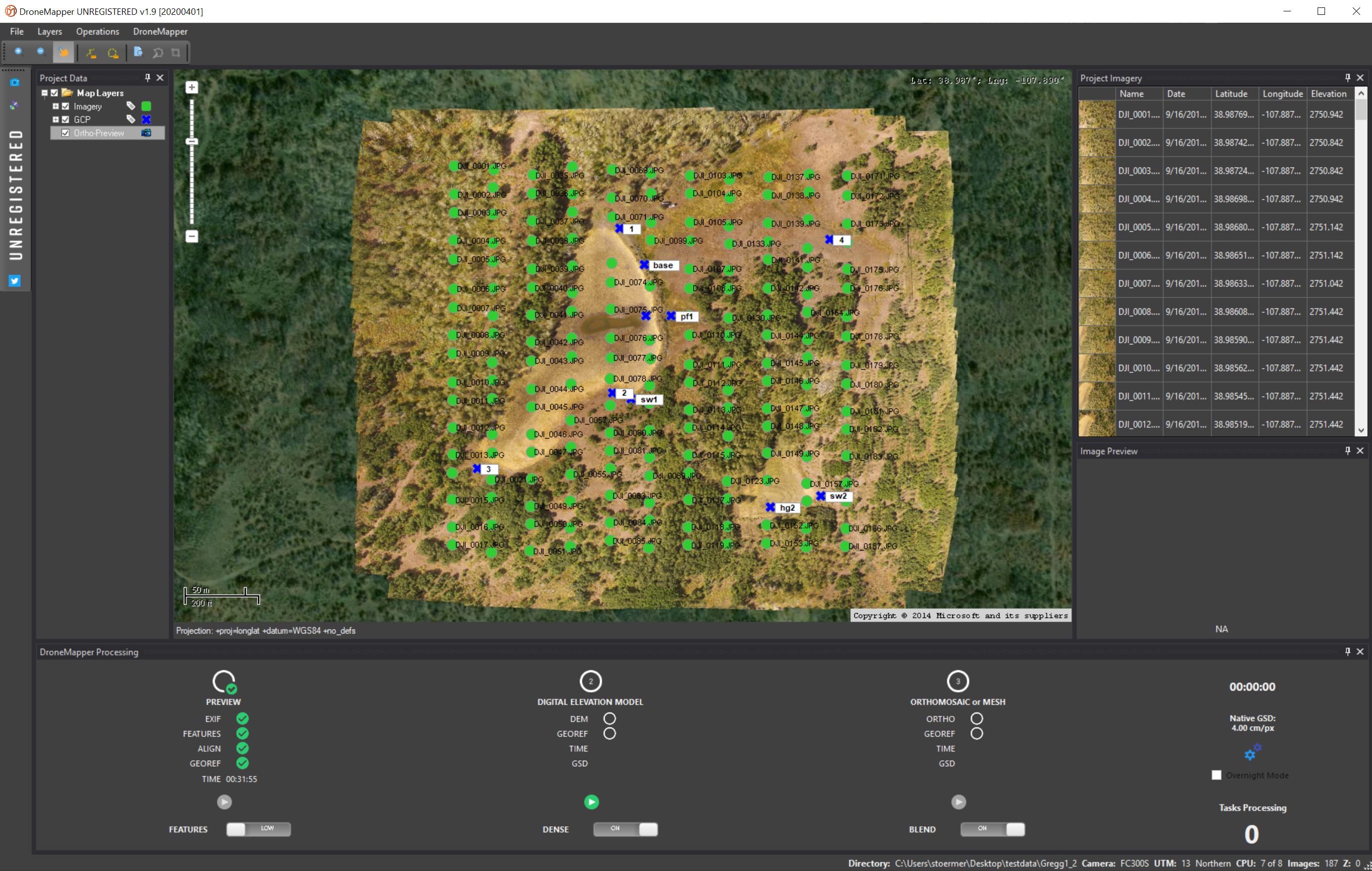
DroneMapper’s RAPID is a one-year licensed Windows (64bit) based photogrammetric imagery processing and GIS application. It is limited to a maximum input of 250 images. RAPID will produce Digital Elevation Models and Orthomosaic maps in GeoTIFF format, WGS84 Lat/Lon projection. For smaller area of interest collections RAPID provides near real time feedback at the site on a laptop computer using the preview orthomosaic function. In a relatively short time the operator can confirm successful aerial collection, pack up equipment and have high confidence in DEM and orthomosaic generation either at the site or back in the office. For topographical, elevation contour and volumetric estimate operations for smaller areas that also require near real time insight – RAPID provides the solution.
When an unregistered version of RAPID is downloaded it is limited in producing just the preview as shown in the illustration above. This serves the purpose of confirming the software installation on your resources is acceptable for full processing.
Once the preview has completed and the DEM start button is activated the next pop up screen prompts for Paypal or Crypto payment. Once paid the RAPID license code is sent to us and we activate the license for the next year, sending the activation code to you via email. Similar perpetual licensing can be selected for REMOTE EXPERT. We only accept Paypal or Coinbase (10% Discount) purchases for RAPID.
Download
Version: v1.9.3 20220420
REMOTE EXPERT
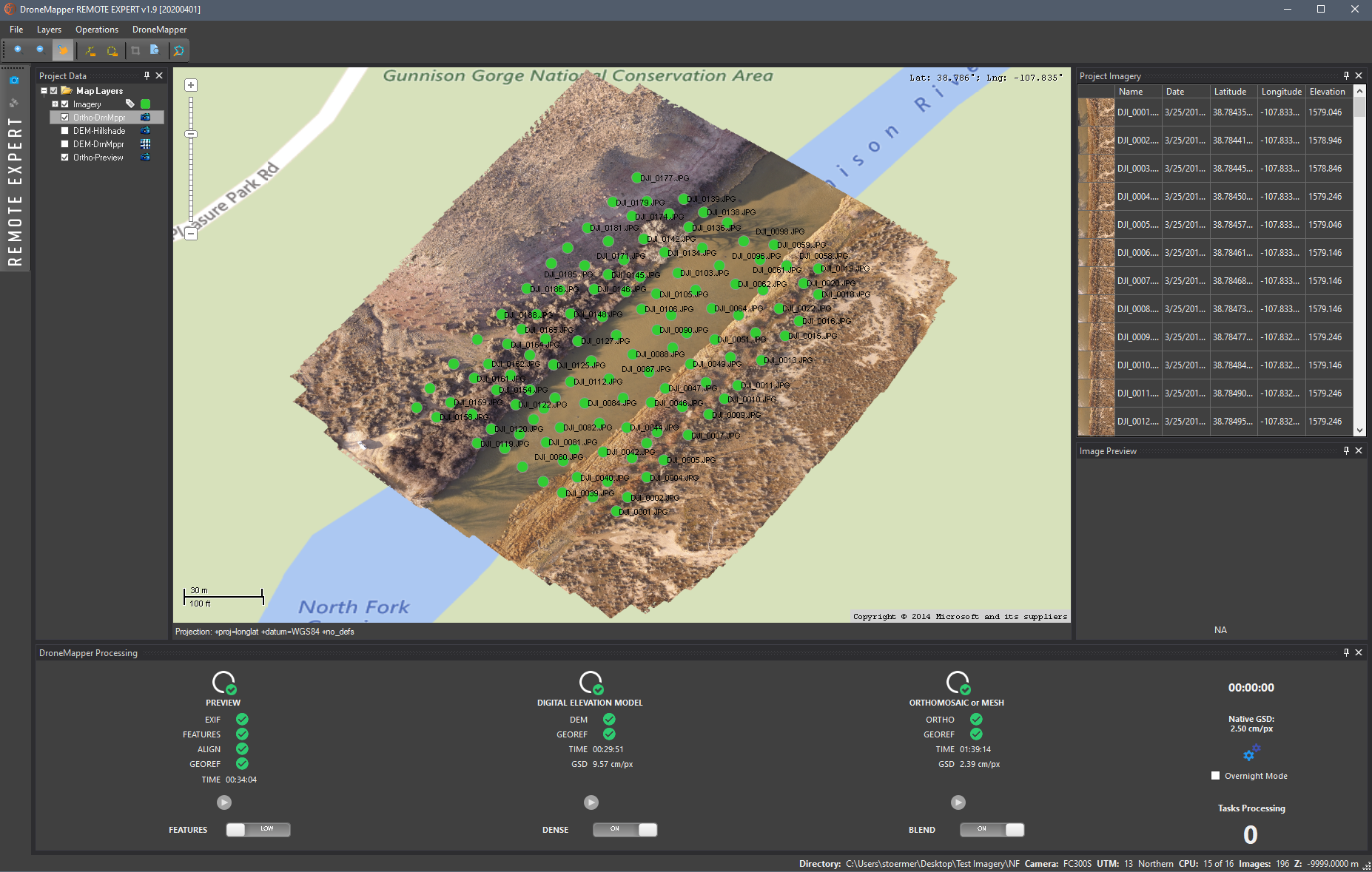
DroneMapper REMOTE EXPERT provides imagery processing from any camera with a maximum input of 10,000 images producing accurate and high quality Digital Elevation Models and Orthomosaic maps in GeoTIFF format. WGS84 Lat/Lon and UTM projections are supported. The operator has the ability to select different output resolutions, oblique processing, 3D model generation, ortho blending, DSM, textured mesh and 64-bit point cloud generation. Forget the time and hassle of transferring your imagery to the cloud. REMOTE EXPERT includes Ground Control Point processing functionality using our efficient GCP creation tool. In addition, REMOTE EXPERT includes advanced feature extraction and computer vision algorithms for difficult scene construction. Our customers receive direct support from DroneMapper and our forums for unique applications and the best methods for optimum output. Download Remote Expert using the link above. If purchasing REMOTE EXPERT and cannot use Paypal or Coinbase (10% Discount) please contact us.
![]()