PrecisionAg & DroneMapper: Pheno-Copter: A Low-Altitude, Autonomous Remote-Sensing Robotic Helicopter for High-Throughput Field-Based Phenotyping

JP Uncategorized

Abstract:

Plant breeding trials are extensive (100s to 1000s of plots) and are difficult and expensive to monitor by conventional means, especially where measurements are time-sensitive. For example, in a land-based measure of canopy temperature (hand-held infrared thermometer at two to 10 plots per minute), the atmospheric conditions may change greatly during the time of measurement. Such sensors measure small spot samples (2 to 50 cm2), whereas image-based methods allow the sampling of entire plots (2 to 30 m2). A higher aerial position allows the rapid measurement of large numbers of plots if the altitude is low (10 to 40 m) and the flight control is sufficiently precise to collect high-resolution images. This paper outlines the implementation of a customized robotic helicopter (gas-powered, 1.78-m rotor diameter) with autonomous flight control and software to plan flights over experiments that were 0.5 to 3 ha in area and, then, to extract, straighten and characterize multiple experimental field plots from images taken by three cameras. With a capacity to carry 1.5 kg for 30 min or 1.1 kg for 60 min, the system successfully completed >150 flights for a total duration of 40 h. Example applications presented here are estimations of the variation in: ground cover in sorghum (early season); canopy temperature in sugarcane (mid-season); and three-dimensional measures of crop lodging in wheat (late season). Together with this hardware platform, improved software to automate the production of ortho-mosaics and digital elevation models and to extract plot data would further benefit the development of high-throughput field-based phenotyping systems.

Download Paper

Precision Agriculture: Vegetation Spectral Indices with NIR Aerial Imagery

JP Uncategorized


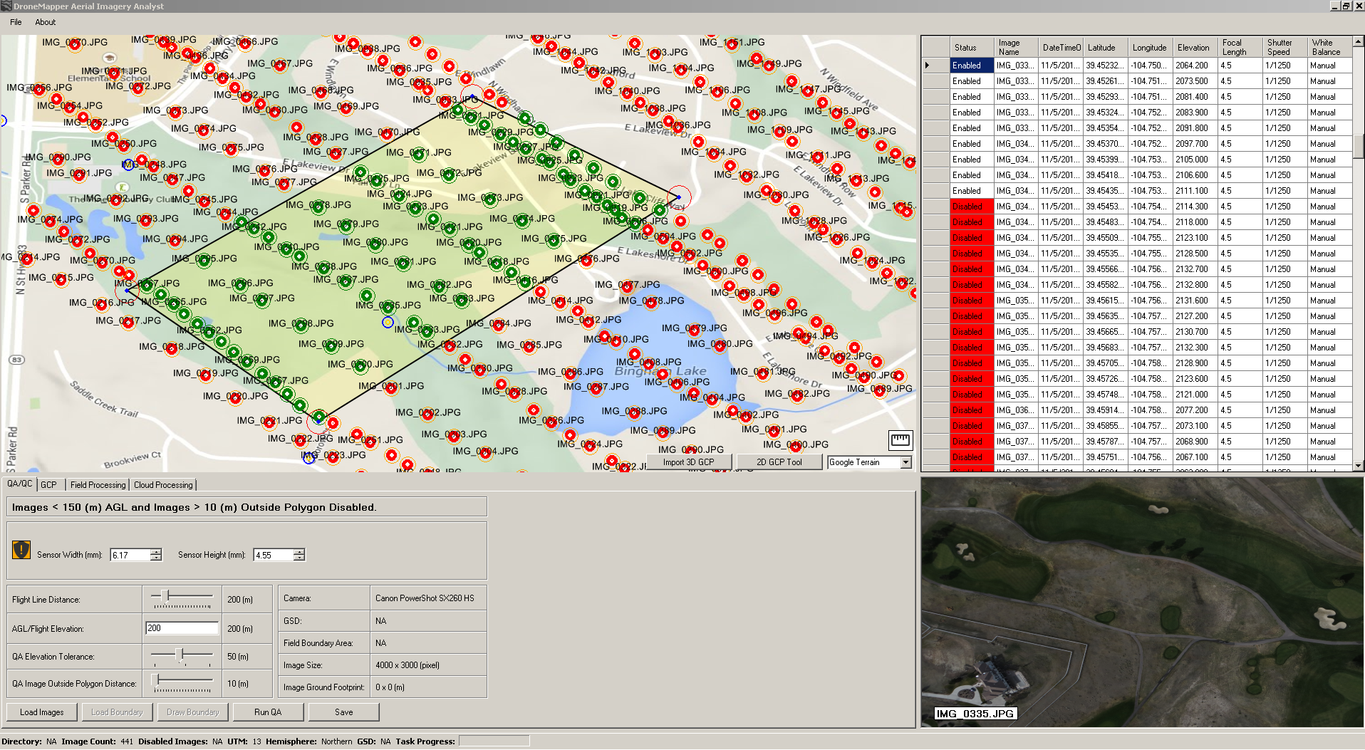
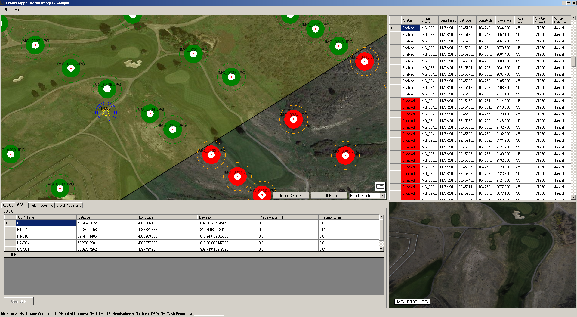
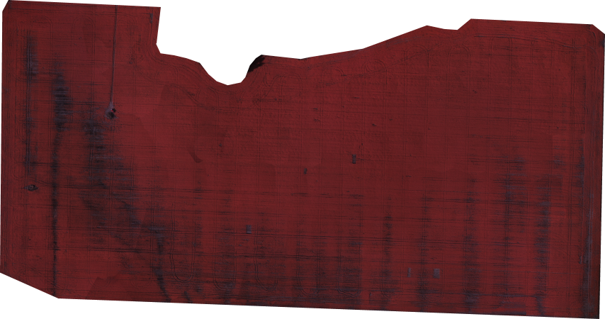
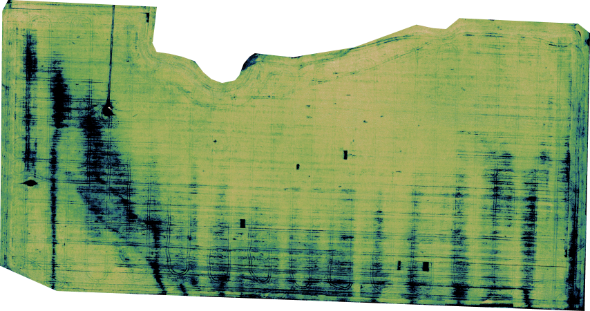
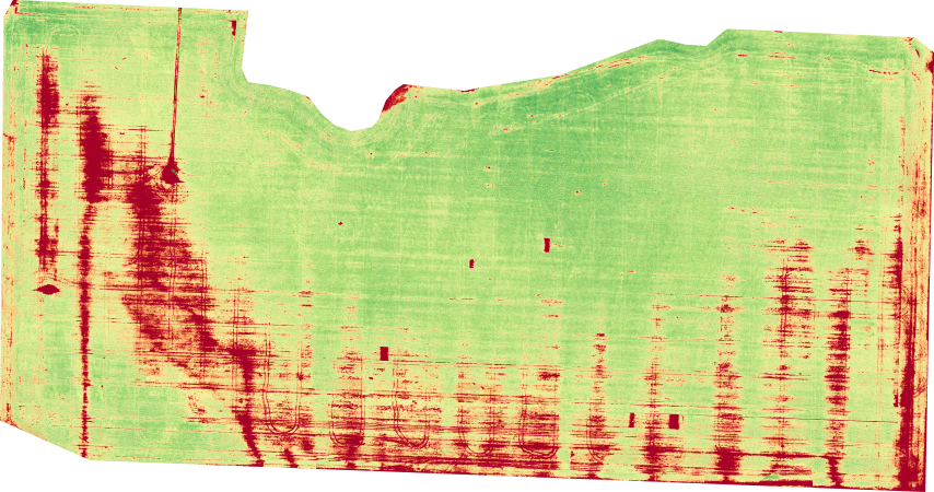
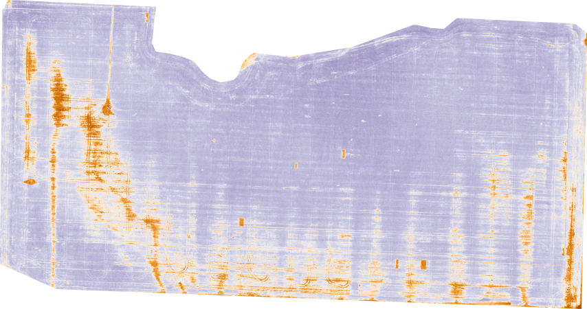
Precision Agriculture and Remote Sensing using UAV aerial imagery is a hot topic of discussion. The amount of valuable information a grower or farmer can obtain at low cost and high resolution can increase crop yield, help determine problem areas, and save time. Geo-referenced aerial imagery in the NIR (near-infrared) band allows precise location of problem areas and the generation of vegetation spectral index maps like the examples below. Multiple data collections over a period of time are very useful for trend and change detection applications. The field below was imaged using an AgEagle UAV platform and a NIR converted maxmax.com Canon SX260HS sensor. The geo-tagged imagery (~225 images @ 12 megapixel) is processed by DroneMapper into a radiometrically equalized geo-referenced Orthomosaic map and Digital Elevation Model (DEM).

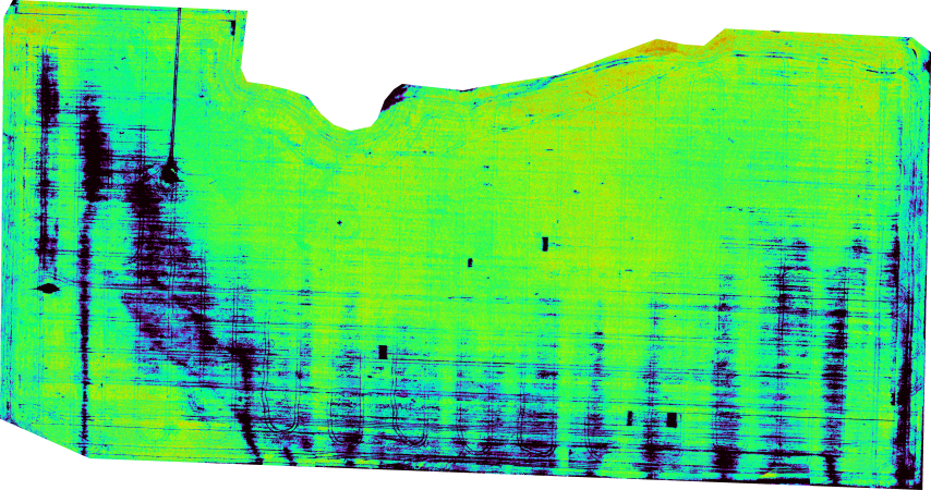
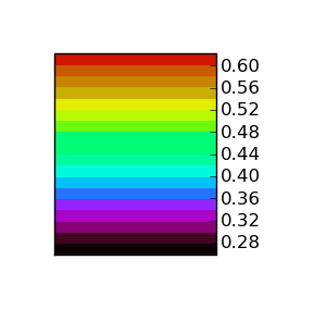
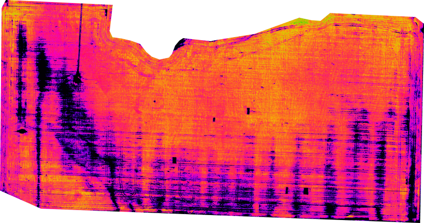
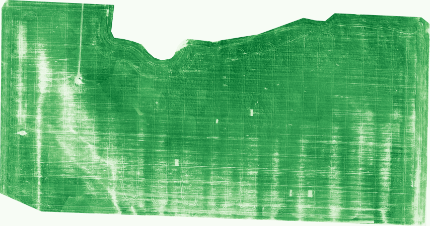
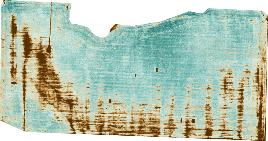
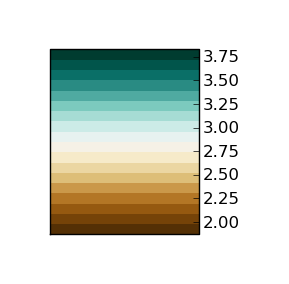
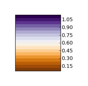
The examples below show various spectral index maps generated from the geo-referenced Orthomosaic at 4 cm per pixel Ground Sample Distance (GSD).

NIR Geo-Referenced Orthomosaic

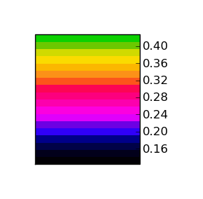
NDVI, Normalized Difference Vegetation Index (maxmax.com) = (NIR – Blue) / (NIR + Blue)

ENDVI, Enhanced Normalized Difference Vegetation Index (maxmax.com) = ((NIR + Green) – (2*Blue) / ((NIR + Green) + 2*Blue))

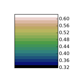
GNDVI, Green Normalized Difference Vegetation Index (Buschmann and Nagel, 1993) = (NIR – Green) / (NIR + Green)

GDVI, Green Difference Vegetation Index (Sripada et al., 2006) = NIR – Green

GIPVI, Infrared Percentage Vegetation Index = NIR / (NIR + Green)

GRVI, Green Ratio Vegetation Index (Sripada et al., 2006) = NIR / Green

GSAVI, Green Soil Adjusted Vegetation Index (Sripada et al., 2006) = [(NIR – Green) / (NIR + Green +L)] * (1 + L), where L = 0.5

References:
* Buschmann, C., and E. Nagel. 1993. In vivo spectroscopy and internal optics of leaves as basis for remote sensing of vegetation. International Journal of Remote Sensing 14:711–722
* Sripada, R.P., Heiniger, R.W., White, J.G., and A.D. Meijer. 2006. Aerial color infrared photography for determining early in-season nitrogen requirements in corn. Agronomy Journal 98: 968-977 etd.pdf
* NDVI History: maxmax.com, ndv_historyi.htm
* Original NIR Aerial imagery courtesy DN2K/MyAgCentral and AgEagle, processed by DroneMapper

Delta County Teen Tech Week

JP Uncategorized


DroneMapper had the pleasure of supporting Delta County Teen Tech week on March 13, 2014, in discussions on drone technology, the various commercial applications drones support and flight demonstration. In the second photo JP and Joshua Ott are discussing the various drone technologies and how very useful information can be derived when the drone is outfitted with a camera. The first photo shows 3-D Robotic’s IRIS in flight piloted by Joshua. As you can imagine the live demo was the highlight of the day!


We would like to extend a very special thank you to both 3-D Robotics for the use of their drone and Joshua Ott for taking the time and effort to support the demo. A set of very special teens are now thinking of what can be.

The DroneMapper Team

Pravia, LLC – NDVI Calibration

JP Uncategorized


The future of farming promises incorporation of novel technologies to generate actionable information that is both affordable and timely. Even small improvements in crop yields can mean significant dollars to the farmer and reduced costs to the consumer. Incorporation of unmanned systems for data collection, value-added algorithms for crop phenomenology, cloud processing and user friendly data exploitation and warehousing are examples of the technologies supporting precision agriculture.

DroneMapper is very pleased to announce it has teamed with Pravia, LLC in generating geo-referenced and radiometrically corrected Normalized Difference Vegetation Index (NDVI) crop maps. NDVIs utilize the near infrared and visible bands to measure “green-ness” of a crop and can be used to identify crop stress. Not only will these maps be accurately geo-referenced but the radiometric correction will allow temporal comparison of the scene for meaningful change detection. A farmer may choose to over-fly the field on a more frequent basis, compare the NDVIs, detect trends in the field and take action.

If you need timely turn-around (< 2 days or better) and very affordable pricing for your NDVIs, please do not hesitate to contact Pravia, LLC and/or DroneMapper for more information on this exciting development.

The Pravia/DroneMapper Team

DN2K, LLC – MyAgCentral.com

JP Uncategorized


DroneMapper is very pleased to announce a collaboration with DN2K and its partners in the development of value-added products for the precision agriculture market utilizing a combination of ground-based and aerial data collections.

DN2K operates a unique service called MyAgCentral (shown in the illustration), a subscription-based service for growers, retailers and service providers that offers precision agricultural data and integration to key software products for managing farms. Examples of data sets include heatmaps that graphically show key farming parameters such as: crop yield, fertilizer application, ground moisture, variable rate irrigation (VRI) and Normalized Difference Vegetation Index (NDVI). DroneMapper provides support to DN2K for terrestrial data visualization and processes geo-referenced orthos in the near infrared along with corresponding NDVI maps of the crop.

Please do not hesitate to contact DN2K (dn2k.com) and/or DroneMapper (dronemapper.com) for more detailed information and how we can support your precision farming needs.

DN2K/MyAgCentral UAS Press Release – March 5th, 2014