We've been busy working on some new features for the DroneMapper system like change detection, object counting, and remote sensing! The example below is of an industrial water treatment plant in the Netherlands. Using the geo-referenced orthomosaic that DroneMapper creates and opencv we can detect certain features and create shapefiles from them. Here the algorithm is looking for round objects of a certain size and attributes. If detections occur, a geo-referenced shapefile mask of the target is created! I am working to add different routines to count and classify different objects in the final orthomosaic. It seems possible to count the number of vehicles, buildings, roads, vegetation, etc once the process and workflow are completed.
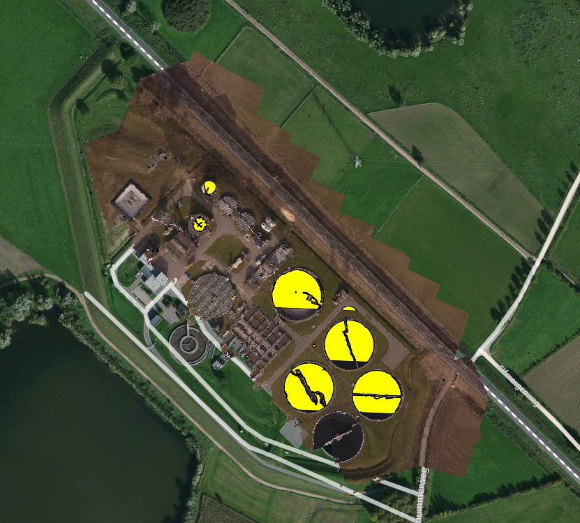
Results of Round Object Detection
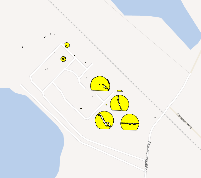
Generated Shapefile Output of Targets on Bing Maps Layer