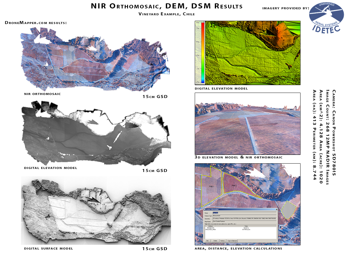
A great example from IDETEC UAV in Chile. This Vineyard map consists of 268 2D NADIR images obtained with a Canon Powershot camera mounted on a IDETEC UAV. The resulting ground sample distance is 15cm.

A great example from IDETEC UAV in Chile. This Vineyard map consists of 268 2D NADIR images obtained with a Canon Powershot camera mounted on a IDETEC UAV. The resulting ground sample distance is 15cm.

The Easter Island Statue Project is doing some amazing work mapping Moai Statues and Easter Island in 3D! Here is a video they produced using the Orthomosaic and Digital Elevation Model results from our imagery processing system. Animation in ArcScene by Kim Anh Hoang with more information available at eisp.org. You can download this dataset from our Sample Data page. Cheers!
FOR IMMEDIATE RELEASE 2012-06-01
Big Mountain Robotics, LLC based in Longmont, Colorado is proud to announce the public release of DroneMapper. The DroneMapper system is a cloud based imagery processing service that turns your 2D aerial images into high resolution geo-referenced Digital Elevation Models, Digital Surface Models, Orthomosaic Maps, 3D Point Clouds and more. Our system offers a wide array of photogrammetry tools including intrinsic calibration, camera adjustment, advanced aerial triangulation, bundle block adjustment, imagery rectification, geo-referencing, and flight tracking at a fraction of the traditional cost. The platform generates very high resolution results with off the shelf consumer quality cameras and affordable UAV hardware. Any UAV or Drone platform is supported with an attached flight controller log, or the pilot may simply geotag each aerial image.
DroneMapper.com will process up to 15 images for free, building a very high resolution geo-referenced DEM, DSM, and Orthomosaic. The resulting output is loaded into any of the popular GIS software packages allowing for accurate contour generation, length, area, volume, cut, fill and elevation measurements.
Early testing with multiple UAV manufacturers has yield excellent results and landed us on the radar of many big name GIS and GPS providers. The DroneMapper web service is based on custom in-house algorithms and freely available open source tools. Imagery is processed on the Amazon EC2 cloud computing cluster resulting in quick turn around and high precision.
For customers who require a non cloud based solution, we offer a Linux based hardware appliance with our software installed. This rack mounted appliance can be installed in your local data center or your secure network, ensuring top level security and privacy for sensitive data.
For more information, questions, sample data, service comparisons and downloads please visit http://dronemapper.com
info[at]dronemapper[dot]com
An interesting dataset from Gatewing UAV. Small section from Easter Island, 140 images in total. 30cm GSD.

Geo-Referenced Orthomosaic of Easter Island (section)
Geo-Referenced Digital Surface Model
Geo-Referenced DEM Viewed w/ Global Mapper – 30cm UTM WGS84 12J Southern Hemisphere
Contour Line Generation Every 10 Meters w/ Ortho and DEM Layers (Global Mapper)
Geo-Referenced 3D Model of Quarry and Moai Statues at Rano Raraku Lake, Easter Island