DroneMapper Signs Multi-Year Contract With The State of Utah

JP Uncategorized

January 28th, 2013


We are very pleased to announce that the Utah Department of Agriculture and Food (UDAF) has contracted with DroneMapper to provide imagery processing services for the next 5 years.  UDAF collects high resolution imagery for use in conservation planning and management of natural resources. As an example, DroneMapper recently processed an imagery set as part of Utah’s effort to mitigate salinity migration into the Colorado River.

UDAF conducted an evaluation of other service providers like DroneMapper and standalone imagery processing software packages, and found that DroneMapper meets their needs in terms of quality and affordability.

We look forward to providing services to the State of Utah and its researchers to keep its lands sustainable and productive. For more information on UDAF, please visit: http://ag.utah.gov/

Red Rocks Amphitheater Photogrammetry Mission with Falcon UAV

JP Uncategorized

January 18th, 2013

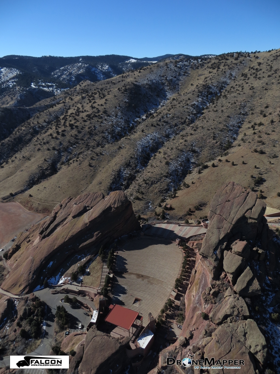
Amazing day in Colorado for a photogrammetry mission with Falcon UAV over Red Rocks Amphitheater, Colorado. At 6,450 feet above sea level, Red Rocks Park is a unique transitional zone where the Great Plains meet the Rocky Mountains. Red Rocks Amphitheatre is a geological phenomenon – the only naturally-occurring, acoustically perfect amphitheatre in the world. Some of the rock formations in Red Rocks slope as much as 90 degrees, while others tilt backwards. The southern monolith, that bears resemblance to a ship, is named "Ship Rock." On the opposite side of the Amphitheatre stands "Creation Rock." Both of the monoliths are taller than Niagara Falls, and the Red Rocks Amphitheatre was once listed as among the Seven Wonders of the World.

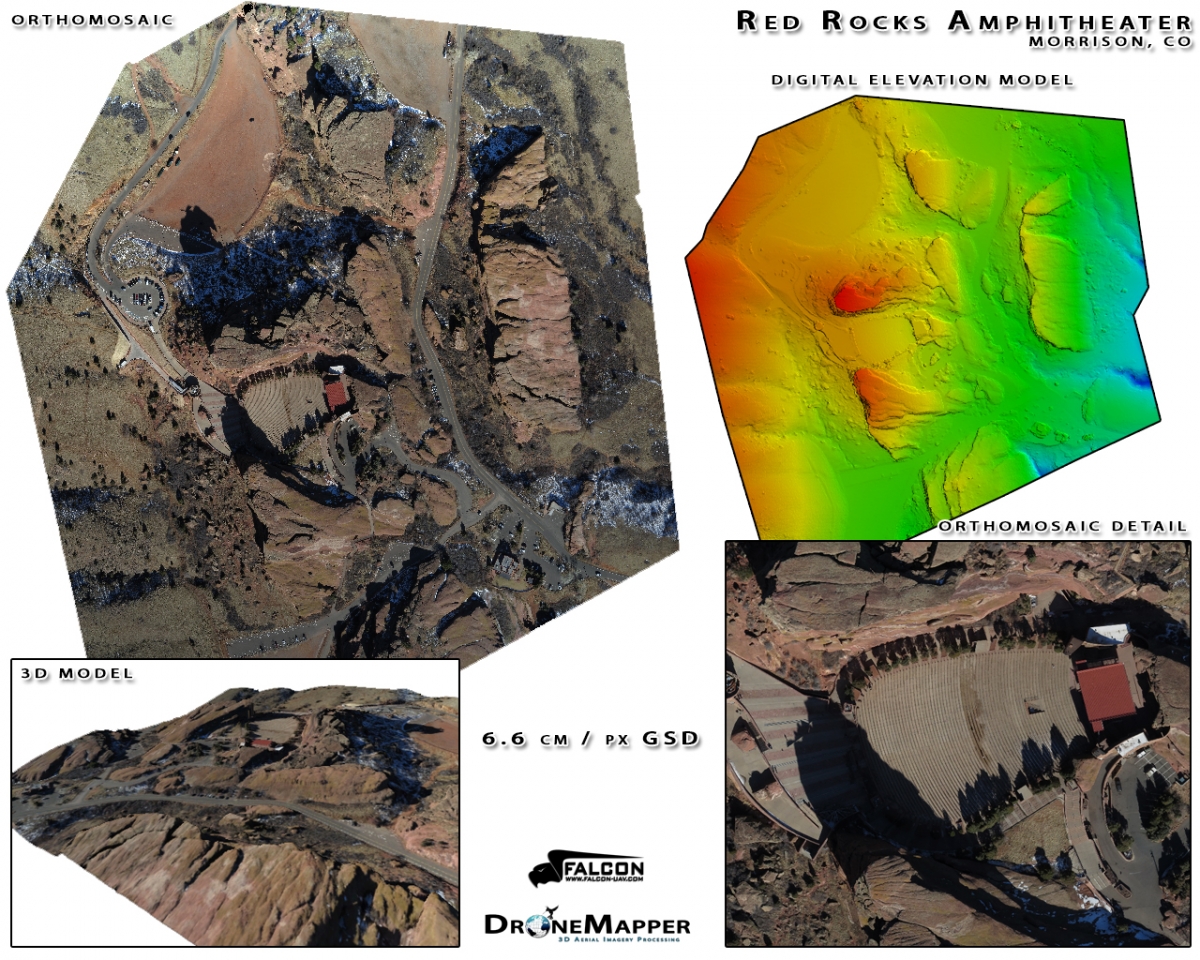
Falcon flew late morning of January 18, 2013 and collected more than 600 photos in a little over 30 minutes. We shot a combination of nadir looking and oblique photos. One of the obliques, shown above looking to the west – southwest, gives the viewer a feel of the scale of the two monoliths that frame the amphitheatre. The nadir images were processed at a resolution of 6.6 cm and the resultant geo-referenced orthomosaic, digital elevation model and 3-D model are also shown below. If you are interested in learning more on how to precisely map difficult terrain please do not hesitate to contact either falcon-uav.com or dronemapper.com

Pinery Geospatial Accuracy Update

JP Uncategorized

January 2, 2013

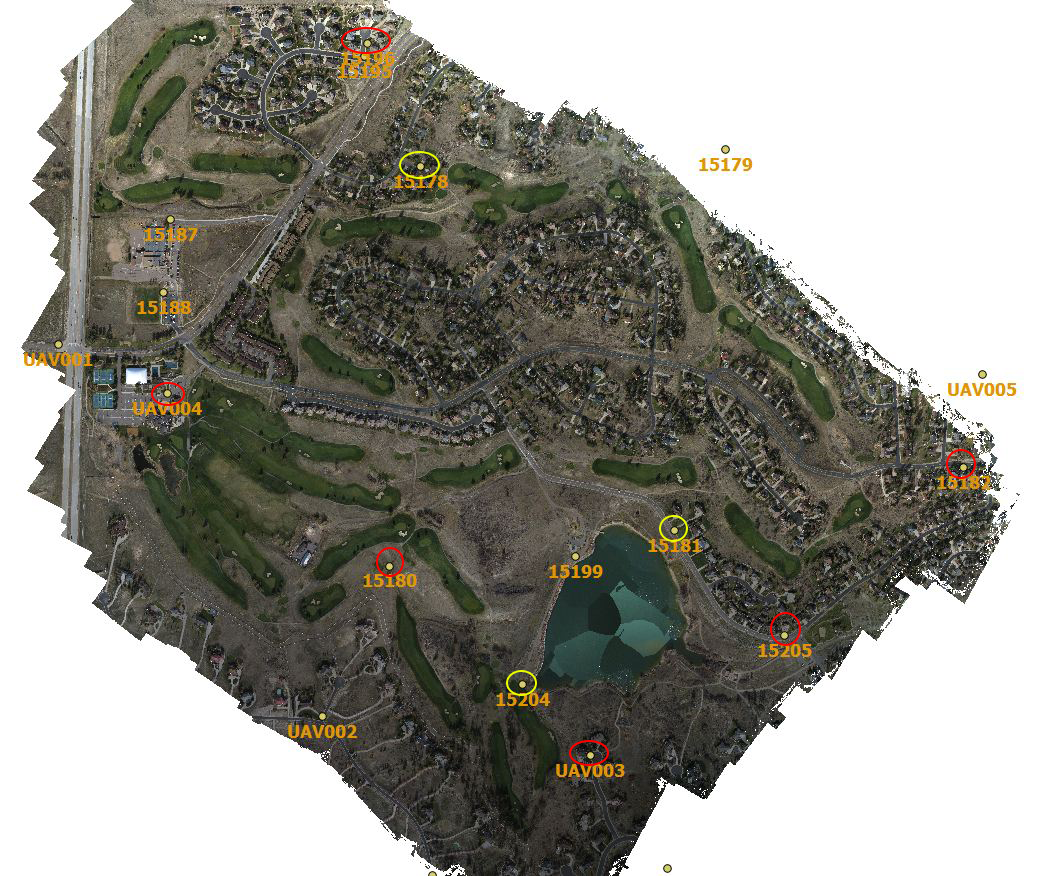
In November 2012 we described the results from an UAV survey (courtesy of Falcon-UAV) conducted over the Pinery Country Club where an area of > 1 square mile was mapped at 6.7 cm resolution. We had access to a set of precision ground control points (GCPs) (courtesy of CompassData, Inc.). The ortho below shows the Pinery area surveyed with a set of ground control used for subsequent data processing and quality control verification. The GCPs circled in red show the original 6 points used in the processing of the DEM with the other 9 used for QA verification. We had a chance to re-process this data with 9 GCPs for the DEM. The additional 3 points selected are shown circled in yellow. The table below illustrates the absolute geo-spatial accuracy improvement by the addition of GCPs.


The table compares the results of the new processing with 9 GCPs (pink or orange) against the former – 6 GCPs (light green). The evaluation conditions are 1) RMSE error in GCPs (gnd control) that were used for processing, 2) RMSE error in GCPs (QA check) that were not used for processing and 3) RMSE error for all 15 GCPs. There was a significant improvement (~ 3 X) in absolute elevation error. The easting accuracy also improved by about 50%. 

DroneMapper Product Improvements, New Features and VTP

JP Uncategorized

December 31st, 2012

We've updated the DroneMapper imagery processing suite with the following fixes and new features for 2013:

  • All GeoTIFF products are clipped to Area of Interest (AOI) mask or AOI shapefile provided by the customer or automatically generated in our processing chain.
  • 32 Bit DEM product is clipped to AOI mask or shapefile automatically.
  • 32 Bit DEM nodata areas have been minimized.
  • 8 Bit DEM remains unchanged.
  • Orthomosaic(s) products have an alpha band indicating nodata and transparency.
  • DSM product is clipped to AOI with nodata set to 0 (black).
  • Improvements to Orthomosaic equalization, blending and color balance.
  • Additional algorithm improvements and testing.
  • New BigTIFF and BigDEM generation, large area tiling and processing workflow.
  • Ground Control Point feature, Windows 2D GCP generation tool.
  • Improvements in website user interface to allow traffic from mobile devices.
  • Improved SSL support.

Please see below for more details on certain features and changes.

The example above shows the original Digital Elevation Model product on the left and new DEM product on the right. The result is clipped to the Area of Interest (AOI) and the nodata values are set to allow transparency.
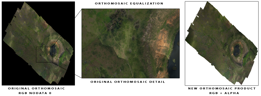
We've made significant improvements with our Orthomosaic color balancing and blending routines. Additionally, we've added an alpha channel to the product for transparency and better support in GIS software packages.

The example above shows the original DSM product on the left. Using an automatically generated mask or customer provided shapefile the AOI is clipped and a new DSM is generated. Nodata values have been assigned to 0 to allow for background transparency display inside GIS software packages.

Virtual Terrain Project (VTP)

Recently we used the open-source Virtual Terrain Project (VTP) which easily constructs any part of the real world in interactive 3D digital form. Ben Discoe and the VTP team have put together a very useful software package and a site packed with great information.
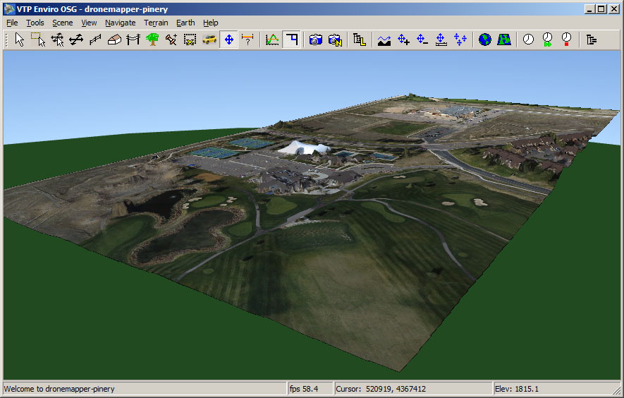
The example screenshot above provided by Ben Discoe shows a portion of the Pinery data set modeled with VTP.


Drone Mapping Easter Island Chile, Rano Raraku Quarry

JP Uncategorized

Decemeber 25th, 2012

Back in May we processed an interesting data set from Easter Island, Chile at 30 cm / px GSD. Kim Anh Hoang from the Easter Island Statue Project used the 30 cm Orthomosaic and DEM to produce a 3D Flyby of Rano Raraku and an EISP excavation site. We've now re-processed the data at the highest resolution possible, 15 cm / px GSD. The original imagery was obtained using an autonomous UAV flying at an elevation (AGL) of ~330 meters with a consumer level Ricoh GR Digital III camera. The GR Digital III is not GPS enabled, so geo-tagging was accomplished locally using the UAV flight controller logs. In total, 140 NADIR images were shot at 10 mega pixel covering an area of 3.7 km^2.

"Rano Raraku is a volcanic crater formed of consolidated volcanic ash, or tuff, and located on the lower slopes of Terevaka in the Rapa Nui National Park on Easter Island. It was a quarry for about 500 years until the early eighteenth century, and supplied the stone from which about 95% of the island's known monolithic sculptures (moai) were carved. Rano Raraku is a visual record of moai design vocabulary and technological innovation, where 397 moai remain. Rano Raraku is in the World Heritage Site of Rapa Nui National Park and gives its name to one of the seven sections of the park." Rano Raraku – Wikipedia

A map of Easter Island/Rapa Nui, showing the three main volcanoes Terevaka, Poike, Rano Kau, as well as Anakena beach, the islets including Motu Nui. Modern Hanga Roa and Mataveri International Airport, the ruins at Orongo and the quarry at Rano Raraku. It marks major ahus with moai.

Above we've displayed a small subset of 8 images from the original 140. We recommend obtaining more overlap and imagery for an area of interest (AOI) this size.

Contact Us for the full geo-referenced downloadable data set.