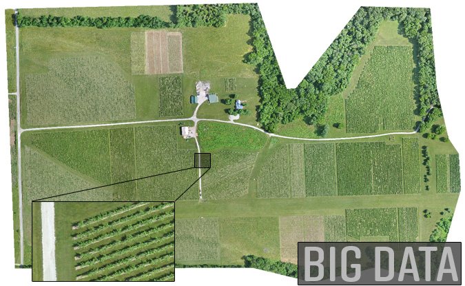
Processing billions of pixels over large areas at high resolution requires serious computing power and algorithms. The image above shows an Orthomosaic map with a Ground Sample Distance (GSD) of 3 cm spanning an area of over 250 acres. The original imagery was obtained using a Precision Hawk fixed wing UAV system and processed by DroneMapper cloud.
Give us a call to discuss your application and how we may possibly help in the solutions you need.