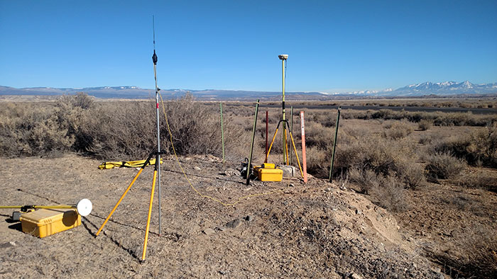
DroneMapper recently acquired Trimble GPS RTK Base and Rover systems for ground survey to augment its aerial imagery collection operations. By combining ground truth, aerial targets and photogrammetric processing one may produce near survey grade digital elevation models (DEMs) and orthomosaics, precisely geo-referenced. Picture 1 illustrates the RTK setup. To get acquainted with the system operation we performed a number of surveys around the DroneMapper business property.
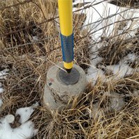
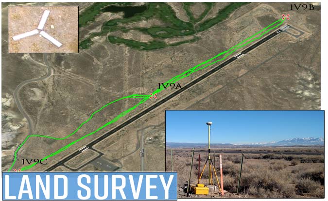
A search of the National Geodetic Survey (NGS) (https://www.ngs.noaa.gov/NGSDataExplorer/) identified three (3) high precision control points located at Blake Field airport, just north of Delta, Colorado. Picture 2 illustrates the control points on the NW side of the airport runway which is about 1 mile long. We utilized the base station to acquire Wide Area Augmentation System (WAAS) coordinates over the 1V9A monument and found the reported WAAS position was within 1 meter of the precise location in XYZ. We then keyed the precise position of the monument into the base station and used the rover to measure the other two monument positions.
If your application requires high quality imagery collection combined with precise control for the highest geo-spatial accuracies please call the DroneMapper team.