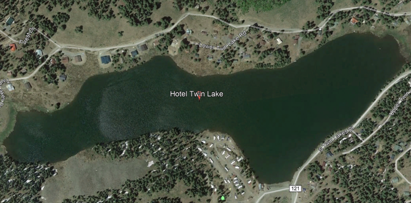
DroneMapper recently mapped a mid-sized reservoir, Hotel Twin Lake, located on the top of the Grand Mesa in Colorado, USA. Figure 1 shows a Google image of the lake at full capacity:
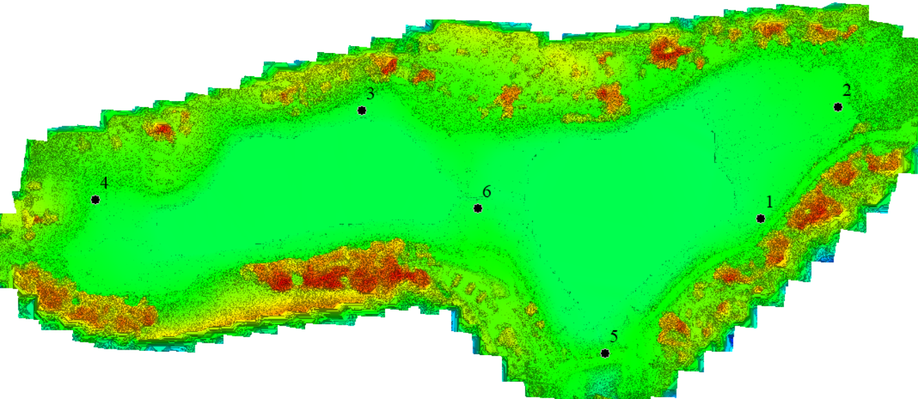
Hotel Twin was drained to its deadpool prior to our drone imagery collection and placement of aerial targets for mapping and ground surveying. 342 images were acquired using a Phantom 3 Advanced drone and six (6) aerial targets or Ground Control Points (GCPs) were precisely ground surveyed for XYZ locations. The imagery and GCPs were processed using REMOTE EXPERT software. Figure 2 illustrates the DEM with GCPs constructed of the reservoir basin:
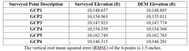
The ground survey of the GCPs was performed using a Trimble GPS/RTK 5800 Base and Rover communicating over a 25-watt UHF Trimble radio (TrimMark 3). The GCP ground surveyed elevations were compared to the elevations measured on the DEM and are shown in Table 1:
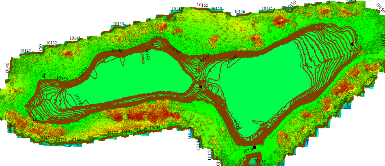
Using Global Mapper GIS software (Blue Marble Geographics, Hallowell Maine) 1-foot contours were generated from the gate valve invert (reservoir’s drain) up to spill. Figure 3 illustrates the DEM with contours superimposed:
Reservoir storage capacity (acre-feet) was computed for each 1-foot contour. The data was fit to a 3rd-order polynomial as shown in the following Figure 4 plot:
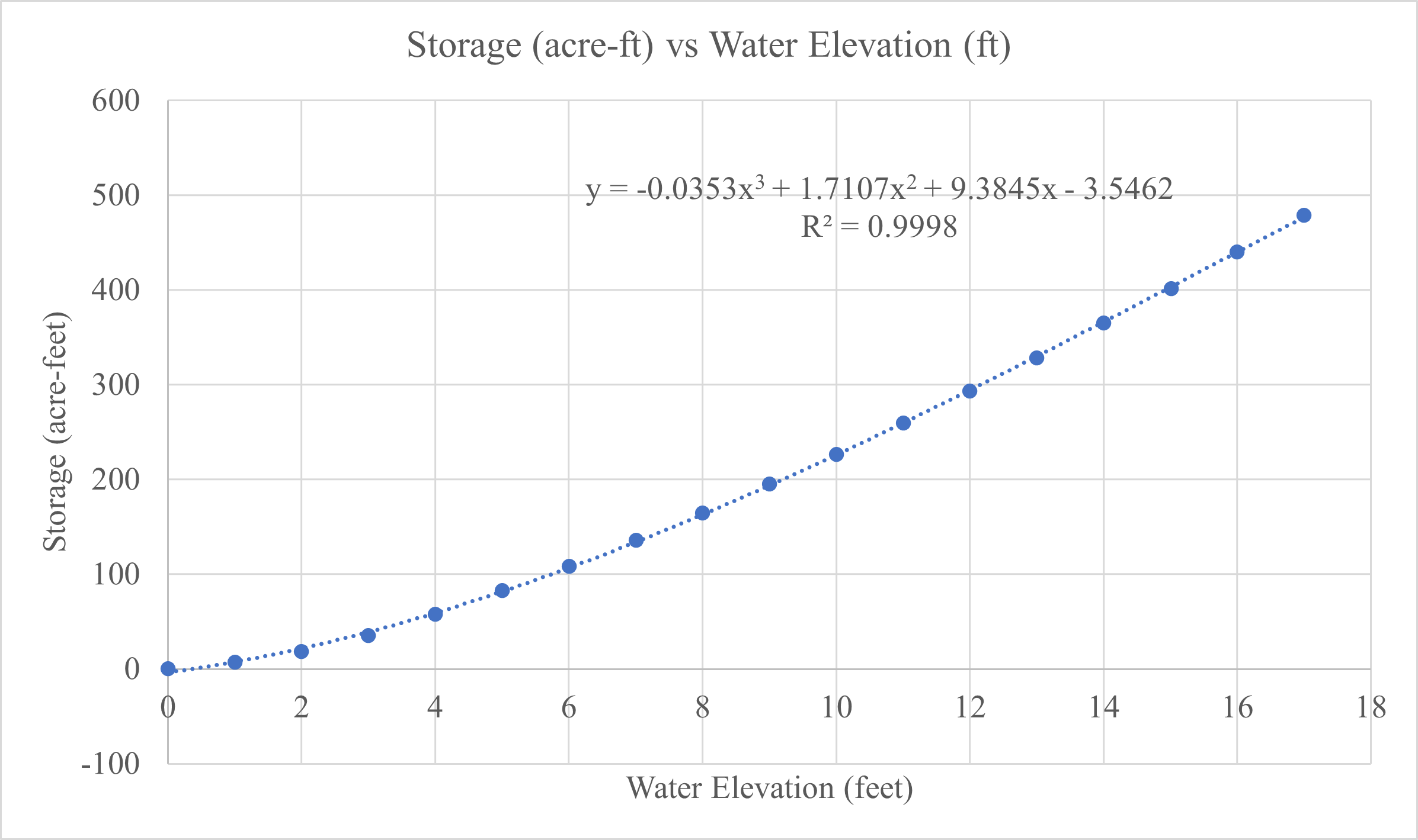
The coefficient of determination, R2, indicates an exceptionally good fit with the 3rd-order polynomial model. You may be asking “what do you do with the polynomial model?” Topic of next discussion -
AquaBits – Real Time Monitoring of Water Resources
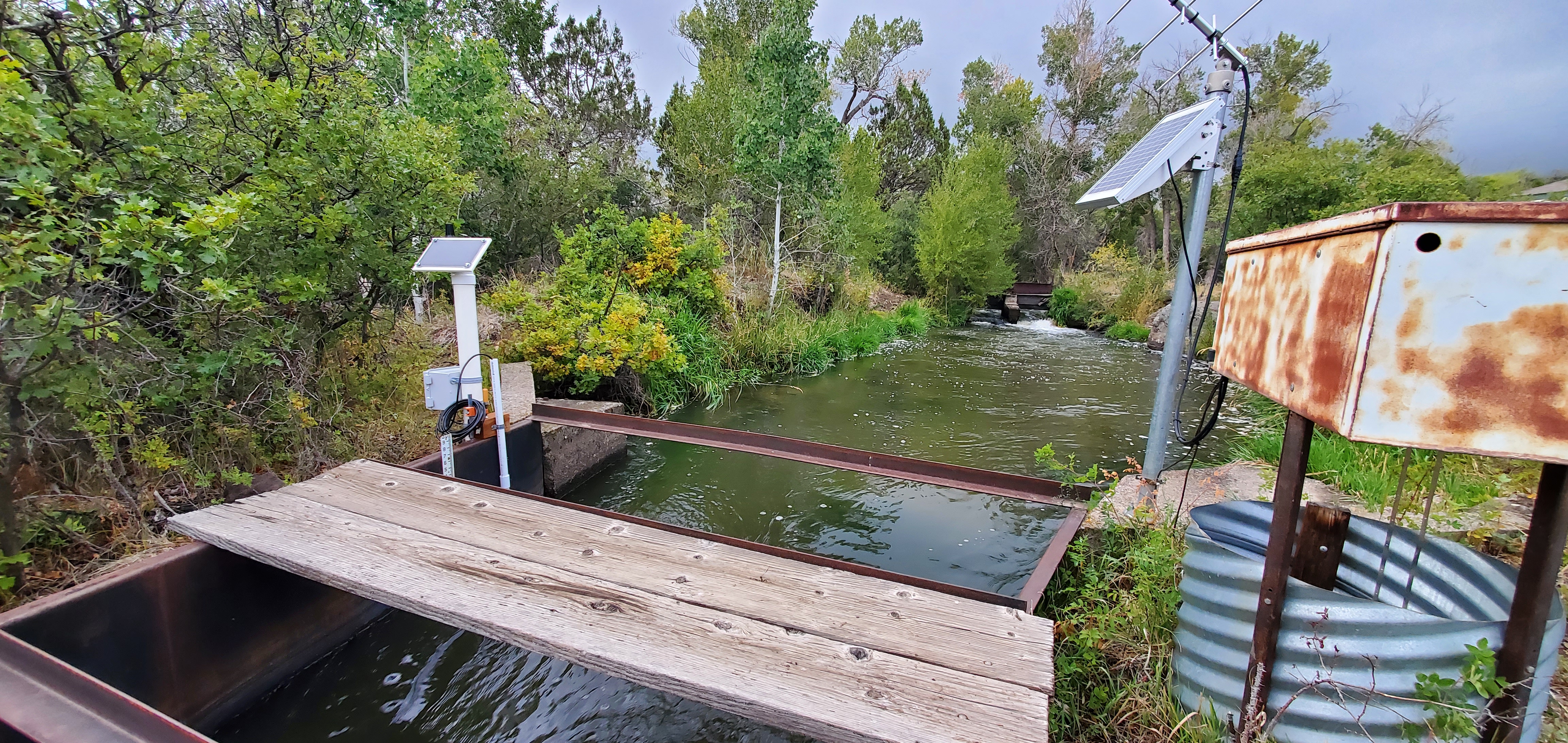
AquaBits is an accurate water resource monitor measuring/reporting gage height of reservoirs and open channels in real time. Water gage height is measured using an immersible hydrostatic pressure, industrial grade sensor. AquaBits reads the sensor at prescribed intervals and sends the measurement using either cellular or satellite communication modems to our aquabits.io web site within 1-minute of data acquisition. Figure 5 illustrates an AquaBits installation for an open channel application:
AquaBits is shown to the left with Colorado state instruments to the right. For Hotel Twin Lake AquaBits was mounted to an existing steel support structure as shown in Figure 6:
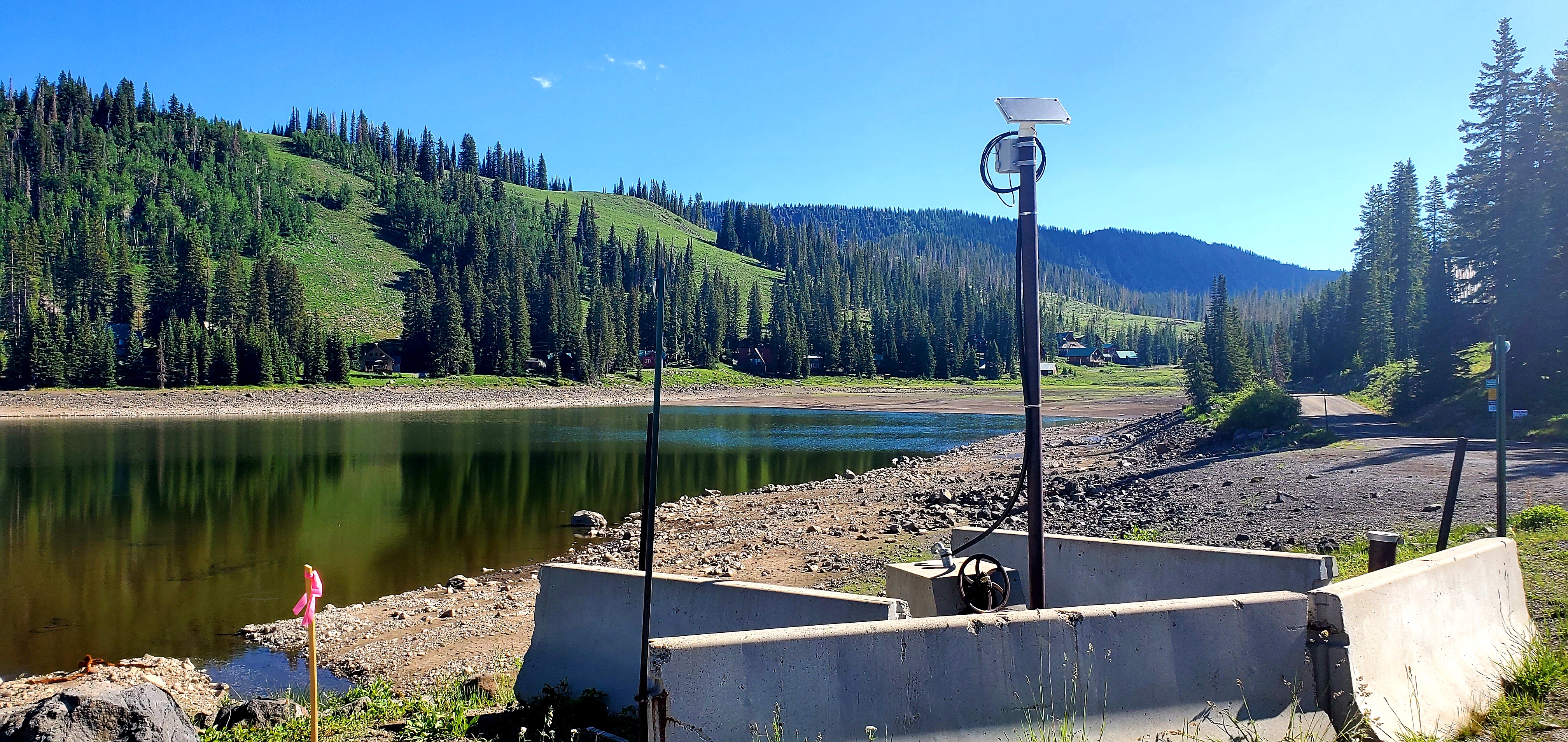
The water sensor is run from the electronics box (just below the solar panel) to the reservoir’s gate valve invert or drain. For this application AquaBits reports every 6-hours and the stored capacity as a function of water elevation is computed using the previously described polynomial model. The lake’s location is remote with no cellular service dictating the use of a satellite modem for data transfer to aquabits.io. Figure 7 shows recent July 2021 data from aquabits.io indicating a slow growth of storage capacity over a couple of days.
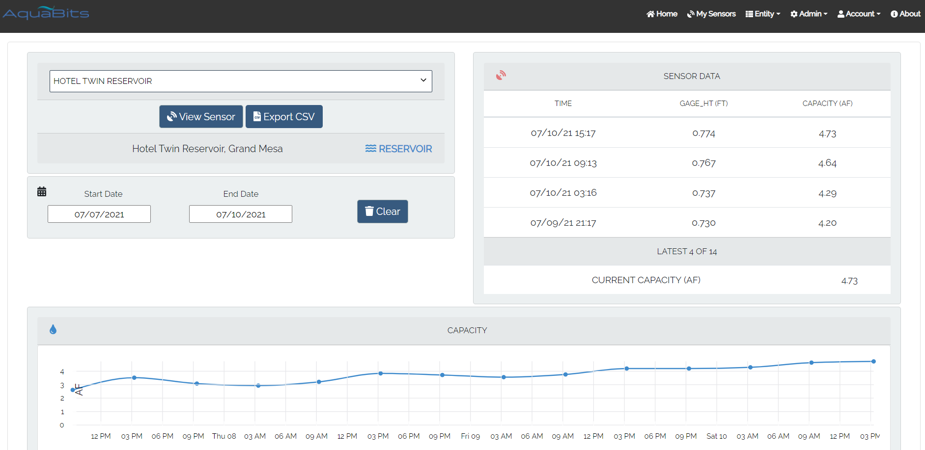
This type of data is particularly useful to understand water ingress, discharge, lake evaporation and possibly predict reservoir’s storage through winter and spring months prior to full thaw and start of the next irrigation season.
Special Equipment and Software Offer
DroneMapper has a hot July special equipment and software offering – a complete drone mapping system with Trimble ground survey and processing software including the following:
Thanks for looking at our blog and please contact us with any questions regarding mapping, AquaBits or our special. The very best for this summer and onwards!
Hotel Twin was drained to its deadpool prior to our drone imagery collection and placement of aerial targets for mapping and ground surveying. 342 images were acquired using a Phantom 3 Advanced drone and six (6) aerial targets or Ground Control Points (GCPs) were precisely ground surveyed for XYZ locations. The imagery and GCPs were processed using REMOTE EXPERT software. Figure 2 illustrates the DEM with GCPs constructed of the reservoir basin:
The ground survey of the GCPs was performed using a Trimble GPS/RTK 5800 Base and Rover communicating over a 25-watt UHF Trimble radio (TrimMark 3). The GCP ground surveyed elevations were compared to the elevations measured on the DEM and are shown in Table 1:
Using Global Mapper GIS software (Blue Marble Geographics, Hallowell Maine) 1-foot contours were generated from the gate valve invert (reservoir’s drain) up to spill. Figure 3 illustrates the DEM with contours superimposed:
Reservoir storage capacity (acre-feet) was computed for each 1-foot contour. The data was fit to a 3rd-order polynomial as shown in the following Figure 4 plot:
The coefficient of determination, R2, indicates an exceptionally good fit with the 3rd-order polynomial model. You may be asking “what do you do with the polynomial model?” Topic of next discussion -
AquaBits – Real Time Monitoring of Water Resources
AquaBits is an accurate water resource monitor measuring/reporting gage height of reservoirs and open channels in real time. Water gage height is measured using an immersible hydrostatic pressure, industrial grade sensor. AquaBits reads the sensor at prescribed intervals and sends the measurement using either cellular or satellite communication modems to our aquabits.io web site within 1-minute of data acquisition. Figure 5 illustrates an AquaBits installation for an open channel application:
AquaBits is shown to the left with Colorado state instruments to the right. For Hotel Twin Lake AquaBits was mounted to an existing steel support structure as shown in Figure 6:
The water sensor is run from the electronics box (just below the solar panel) to the reservoir’s gate valve invert or drain. For this application AquaBits reports every 6-hours and the stored capacity as a function of water elevation is computed using the previously described polynomial model. The lake’s location is remote with no cellular service dictating the use of a satellite modem for data transfer to aquabits.io. Figure 7 shows recent July 2021 data from aquabits.io indicating a slow growth of storage capacity over a couple of days.
This type of data is particularly useful to understand water ingress, discharge, lake evaporation and possibly predict reservoir’s storage through winter and spring months prior to full thaw and start of the next irrigation season.
Special Equipment and Software Offer
DroneMapper has a hot July special equipment and software offering – a complete drone mapping system with Trimble ground survey and processing software including the following:
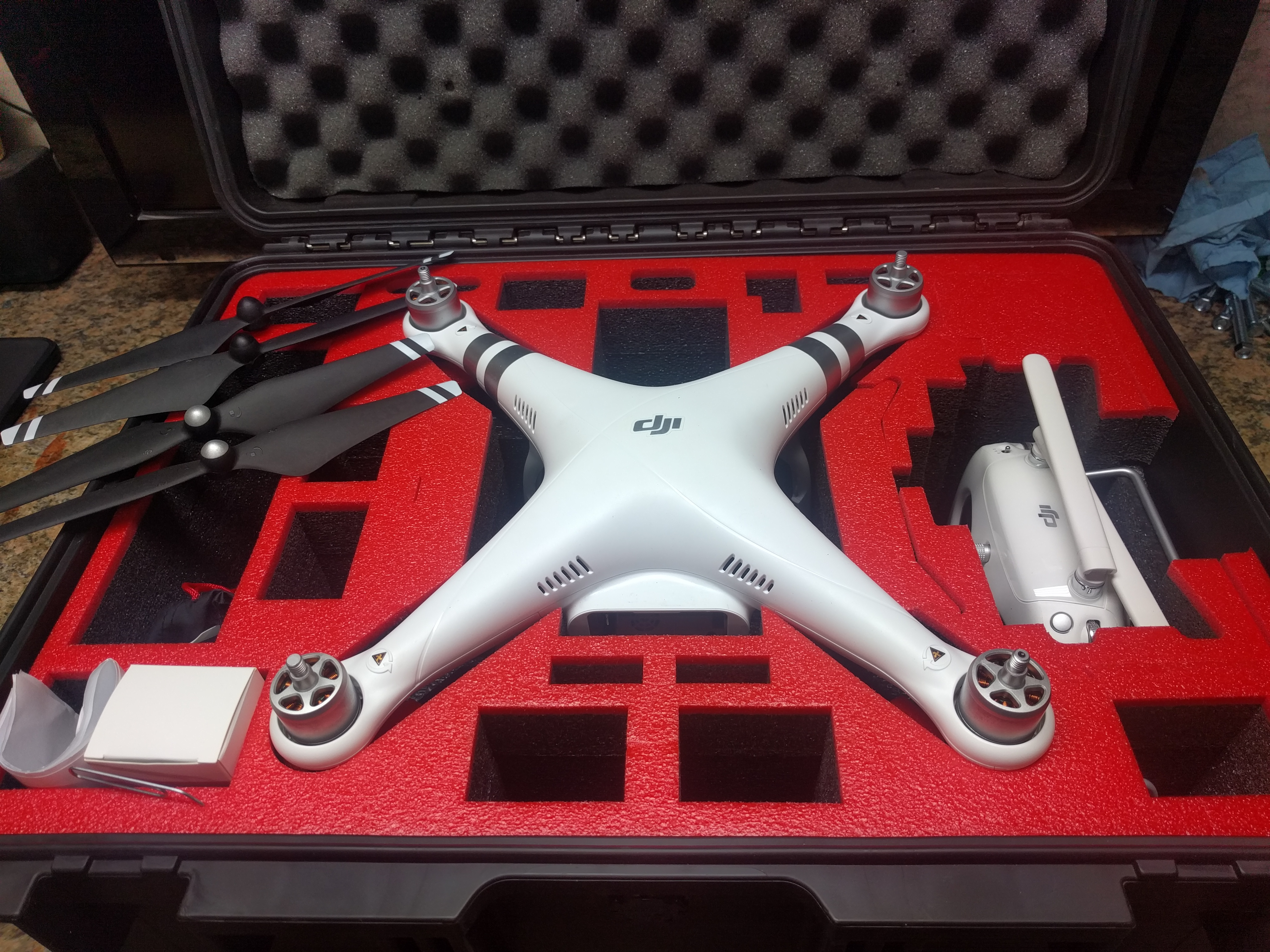
- DJI Phantom 3 Advanced drone complete with Pelican roller case (see Figure 8):
- Less than 1 hour flight time on P3A (used as backup spare for our operations),
- Additional NIR modified camera (NIR,G,B) used for crop health monitoring,
- Value estimated at $500-1,000 (used)
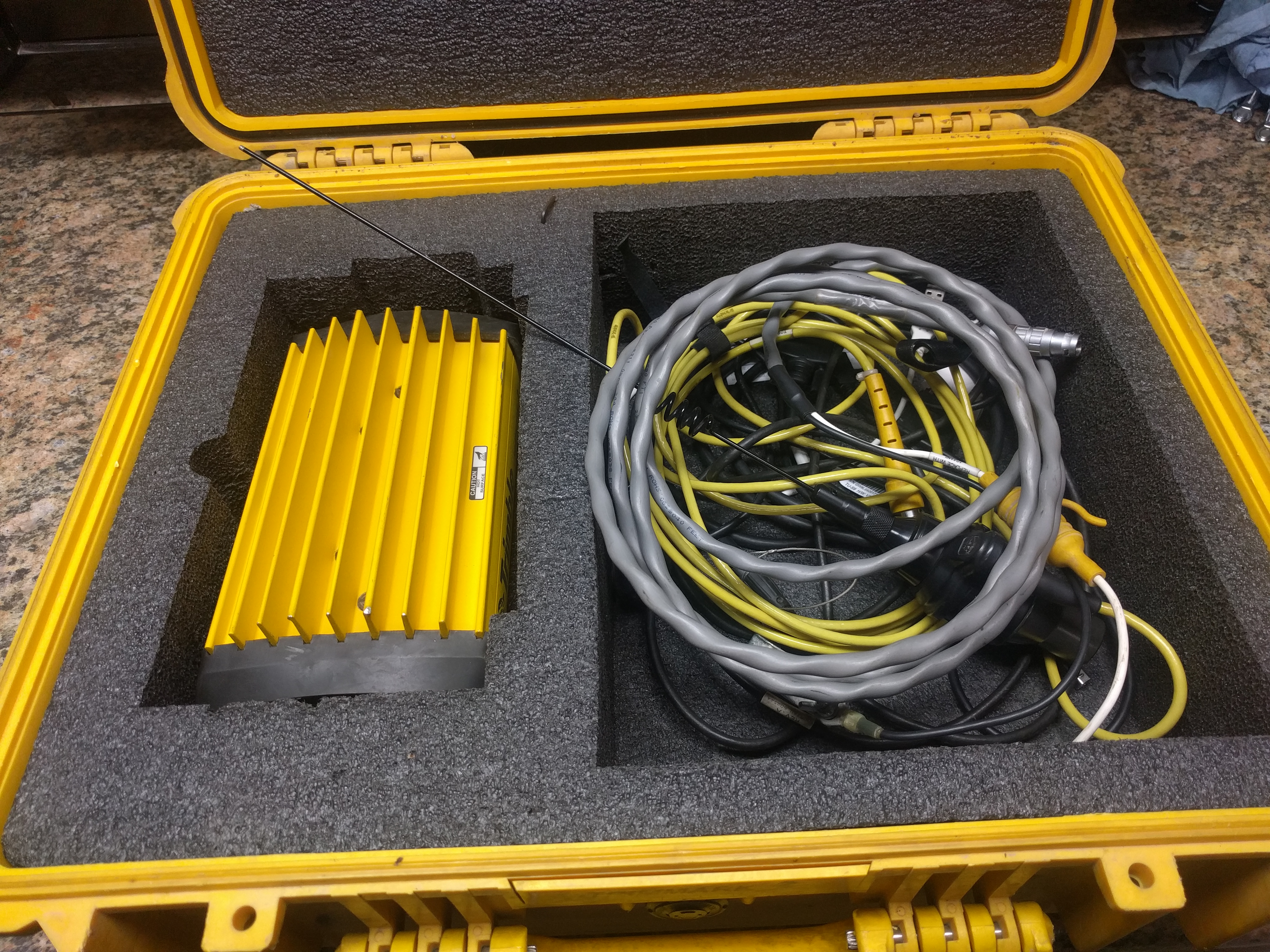
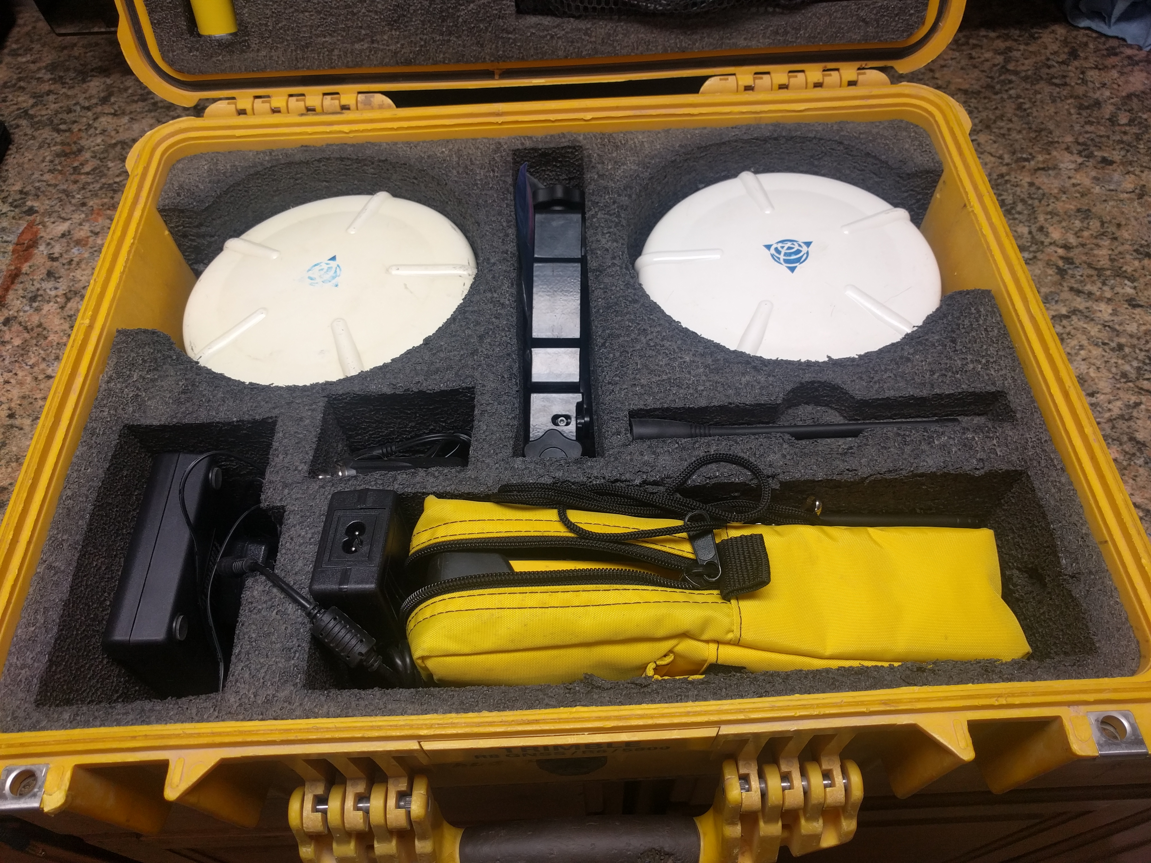
- Trimble GPS RTK 5800 Base, Rover and UHF Radio complete, housed within two cases (see Figures 9 & 10):
- Base and Rover Receivers (batteries/charger included),
- TSC Controller (battery/charger included),
- 2-10-25-watt, 450-470 MHz Radio (battery not included)
- All cables and antennas,
- Value estimated at $3,000-4,000 (used)
- Perpetual license for REMOTE EXPERT photogrammetric processing software:
- Produce DEMs, orthos, point clouds, with or without GCPs,
- License cost - $999
- Complete precision mapping system offered at $3,500 plus shipping. All you need to add is the aerial targets, tripods and survey rods.
Thanks for looking at our blog and please contact us with any questions regarding mapping, AquaBits or our special. The very best for this summer and onwards!