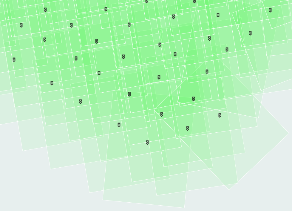
We’ve implemented some basic data collection quality assurance and quality control tools inside the DroneMapper web interface. For each flight uploaded, we now generate an image footprint polygon layer. The polygons are oriented by obtaining the bearing between Latitude and Longitude points along the flight line, the size of the polygon is computed using the ground sample distance (GSD), sensor size and image size. The intention is to give you an idea of the overlap and imagery coverage over the area of interest, clearly showing large holes or gaps in the flight data collection. Other additions include basic EXIF geo-tag sanity checks such as unique Latitude and Longitude, consistent focal length, shutter speed / exposure time and missing altitude tags.
QA/QC Checks:
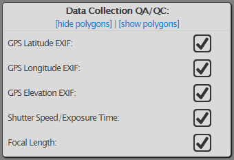
Image Footprint Polygons:
The image below represents an ideal data collection courtesy of Morgan from New Zealand. The flight is over mountainous terrain and has large areas of homogeneous ground cover. The image footprint polygons are visible and highlight the overall quality of the data collection. Morgan provides some additional information, and tips for other operators:
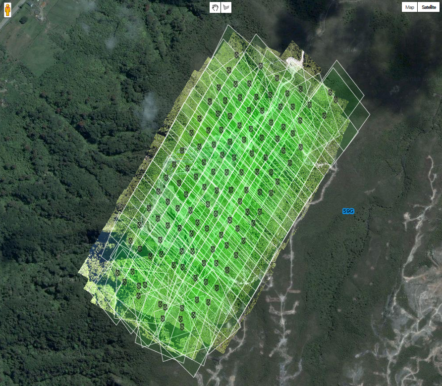
“If people ask you for tips and you don’t already know the following then feel free to tell them that flight was at 75% overlap, flown into and with the wind (so I got less crabbing of the air frame). I also triggered the camera based on distance, not time, so shot spacing was consistent. I also set the camera to program mode (not auto), set my (White Balance) WB to cloud or sunny (not auto) and ensure my shutter speed is above 1/1200. Camera is a SX260HS loaded with a CHDK script Jeff Taylor made – here’s a link: http://diydrones.com/profiles/blogs/apm-to-chdk-camera-link-tutorial” –Morgan