RAPID – New Release of the Free Imaging Processing Application, August 31, 2017
Pierre Stoermer, CEO – DroneMapper.com
Pierre Stoermer, CEO – DroneMapper.com
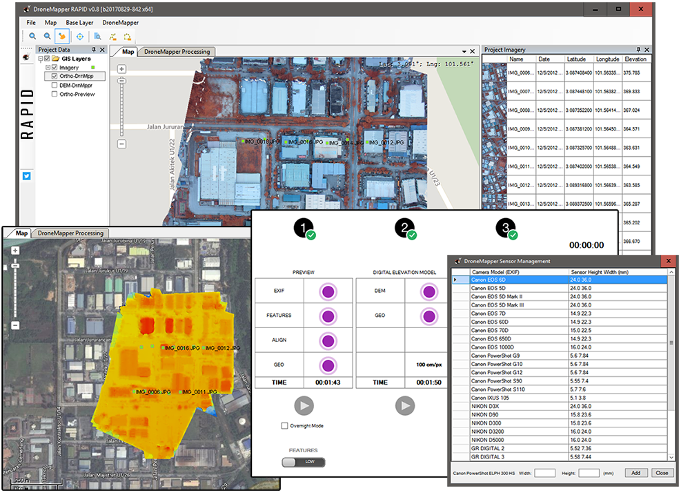
DroneMapper has just released a new version of RAPID, formerly known as RAPID for DJI. This free
photogrammetry application has been modified to work with any camera sensor or UAV platform — where before it only
processed imagery from DJI cameras. It still does, but this version can be used with any non-DJI sensor as
well, including large format compacts and DSLRs, multi-spectral-multiple aperture sensors and thermal
sensors. If the sensor to be processed is not in the existing RAPID camera catalog or automatically detected then the user merely
specifies the focal plane height and width in millimeters to utilize existing camera calibration algorithms.
Features include:
- Up to 150 JPG image input,
- Low resolution DEM (X8) and Ortho (X4) output in GeoTiff format,
- Geo-referenced output products in UTM WGS84 coordinates,
- Low-latency preview Ortho generation for field verification of imagery collection,
- It’s free – use it for personal or business applications.
Thank you, The DroneMapper Team