Jon-Pierre Stoermer, CTO – DroneMapper.com
We often get requests from our customers to develop additional value-added features and algorithms to extract more meaningful information from aerial or terrestrial data collections. Recently, the area of Precision Agriculture has seen enormous growth triggered by reduced technology costs and overall interest in new/emerging technologies. The integration of UAS systems, GPS, RTK and other geo-spatial technologies into the farming sector allows a whole new world of opportunities. Although technology can't solve all of our tasks, it can certainly help in new and exciting ways!
A common task for an Agronomist is the creation of management zones or "area's of interest" based on the available data. The data could be an aerial imagery collection in NIR, yield data from a terrestrial collection, EC soil samples, or a combination of all. Historically, a large amount of research has been devoted to automating the process of extracting appropriate zones when high resolution spatial data is available. This can also be a complicated and time consuming task.
"Normalized difference vegetation index (NDVI) are closely related to many vegetation parameters such as leaf area index, vegetation cover, vegetation biomass and crop growth, so is often used to monitor crop growth and predict crop yield." [1]
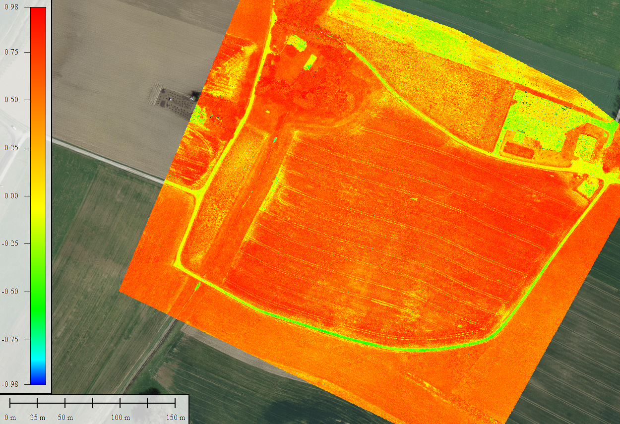
NDVI GeoTIFF
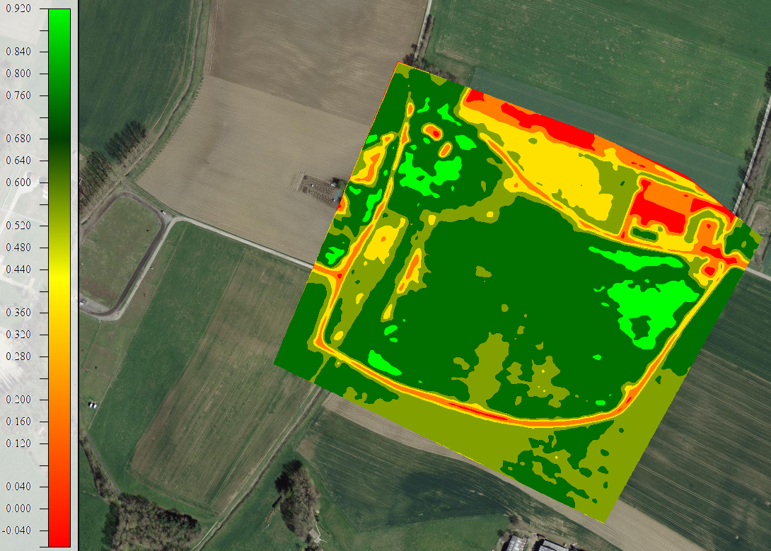
Classified NDVI GeoTIFF
The image above shows a classified NDVI GeoTIFF where each pixel falls into one of the following categories:
- VL – Very Low Health
- L – Low Health
- A – Average Health
- H – Healthy
- VH – Very Healthy
- EH – Extreme Health
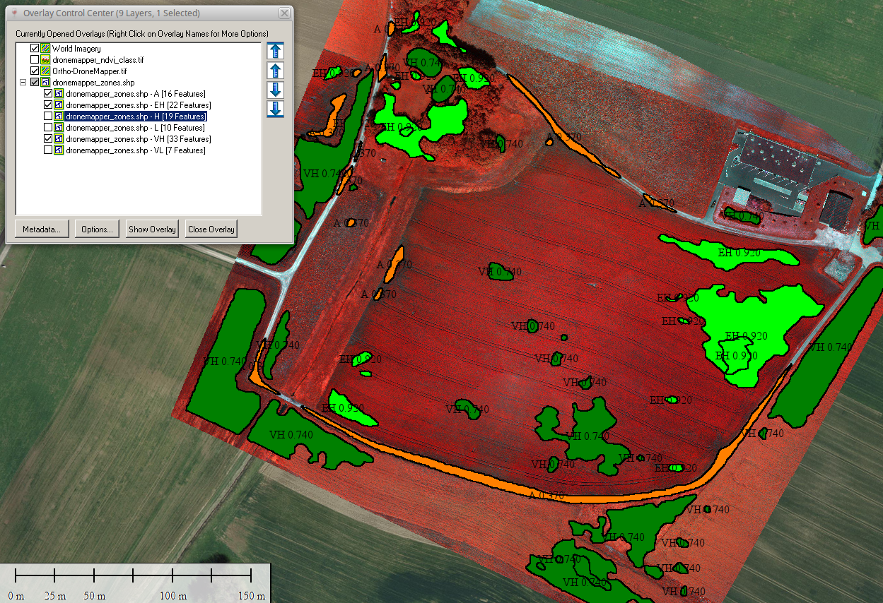
Once classification is completed, DroneMapper generates a shapefile with management zones. The shapefile output is UTM WGS84 format and compatiable with major agriculture software providers such as SST, SMS, Apex, etc.
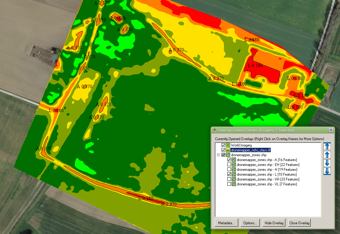
Classified NDVI GeoTIFF w/ Shapefile Overlay – "A" and "L" Management Zones Highlighted
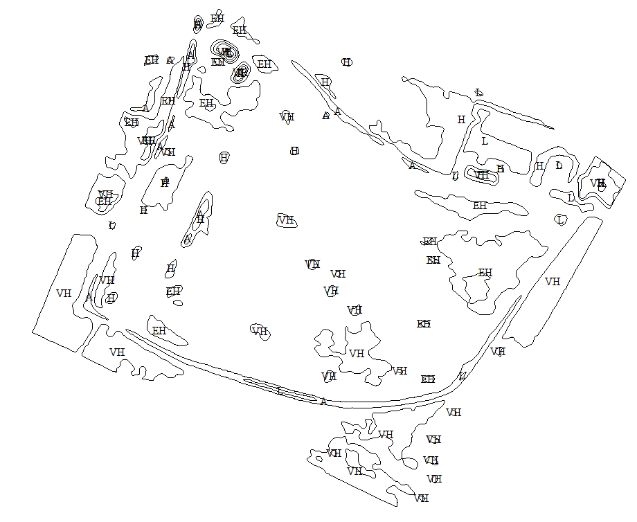
Shapefile w/ All Management Zones Shown (UTM 32 Northern)
Each polygon in the generated shapefile includes records in the .dbf file with the following information:
- Classification – 'class'
- NDVI Indice Value – 'z'
- Fill Color – 'color'
- Polygon Id – 'id'
- Area Acre – 'area'
This allows sorting or grouping of the polygons based on .dbf column values.
"EH", "A" and "VH" Management Zones w/ NIR Orthomosaic
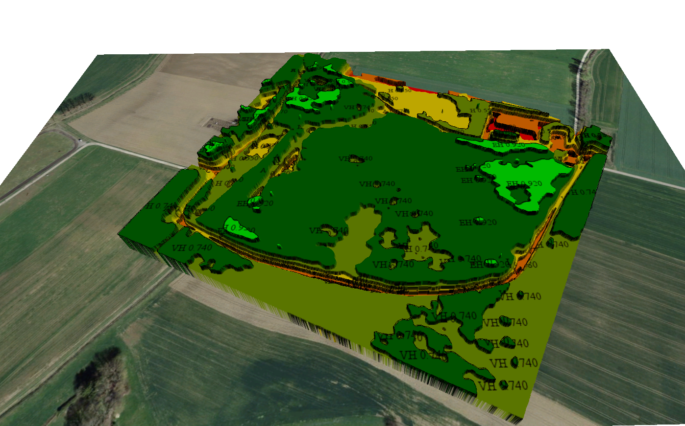
A 3D Geo-Referenced Crop Health Map (viewed in GlobalMapper)
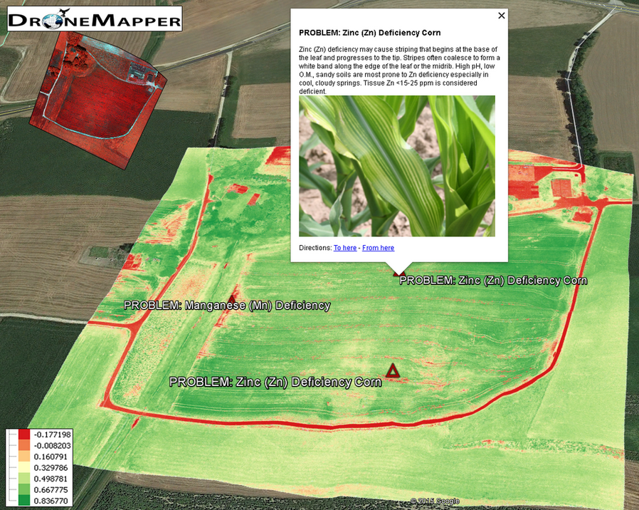
KML/KMZ Representation of Alerts and Area’s of Interest
The algorithm completes processing after a few minutes and could easily be adapted to provide point data for Crop Scouting locations, ground truthing, etc.
Download the data generated in this post here or on our samples page. For more information on agriculture management zones we recommend the following link. Please let us know if you have any questions!