Introducing DroneMapper Imagery Analyst! We've been working on this for a while now and it is getting close for prime time. Keep an eye out for more details in the coming weeks!
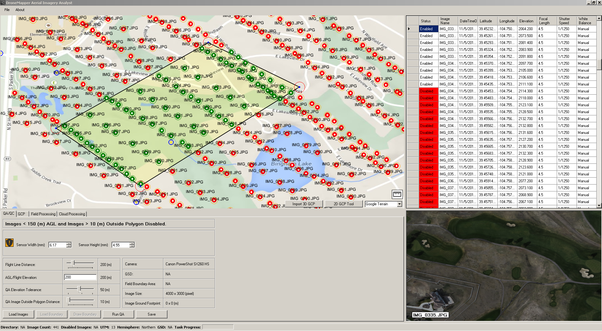
EXIF Geotag QA/QC checks.
EXIF Geotag Altitude checks.
Image RPY (Roll Pitch Yaw) filters.
Filtering of imagery with shapefile AOI (Area of Interest).
Filtering of imagery with hand drawn AOI.
Advanced PIP (Point in Polygon) filtering and features.
Imagery EXIF metadata tables and imagery preview.
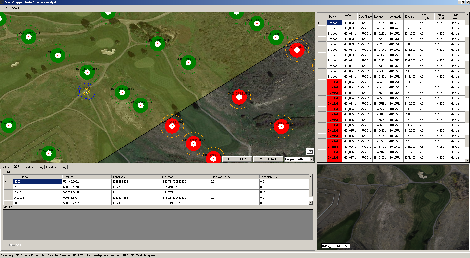
Advanced GCP (Ground Control Point) tool and GCP mapping.
Rapid off-line field processing.
Cloud processing provider interaction. (DroneMapper & MyAgCentral currently)
Post processing, NDVI generation, Point Cloud interaction.
Off-line map mode, no internet connection required.
Should be a very nice compliment to existing mission planning and ground station software packages. (integration options)
We've completed a large chunk of the feature set and we are ready to start beta testing.