Decemeber 25th, 2012
Back in May we processed an interesting data set from Easter Island, Chile at 30 cm / px GSD. Kim Anh Hoang from the Easter Island Statue Project used the 30 cm Orthomosaic and DEM to produce a 3D Flyby of Rano Raraku and an EISP excavation site. We've now re-processed the data at the highest resolution possible, 15 cm / px GSD. The original imagery was obtained using an autonomous UAV flying at an elevation (AGL) of ~330 meters with a consumer level Ricoh GR Digital III camera. The GR Digital III is not GPS enabled, so geo-tagging was accomplished locally using the UAV flight controller logs. In total, 140 NADIR images were shot at 10 mega pixel covering an area of 3.7 km^2.
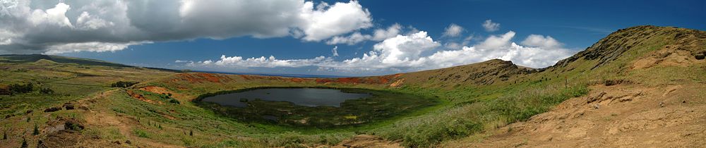
"Rano Raraku is a volcanic crater formed of consolidated volcanic ash, or tuff, and located on the lower slopes of Terevaka in the Rapa Nui National Park on Easter Island. It was a quarry for about 500 years until the early eighteenth century, and supplied the stone from which about 95% of the island's known monolithic sculptures (moai) were carved. Rano Raraku is a visual record of moai design vocabulary and technological innovation, where 397 moai remain. Rano Raraku is in the World Heritage Site of Rapa Nui National Park and gives its name to one of the seven sections of the park." Rano Raraku – Wikipedia
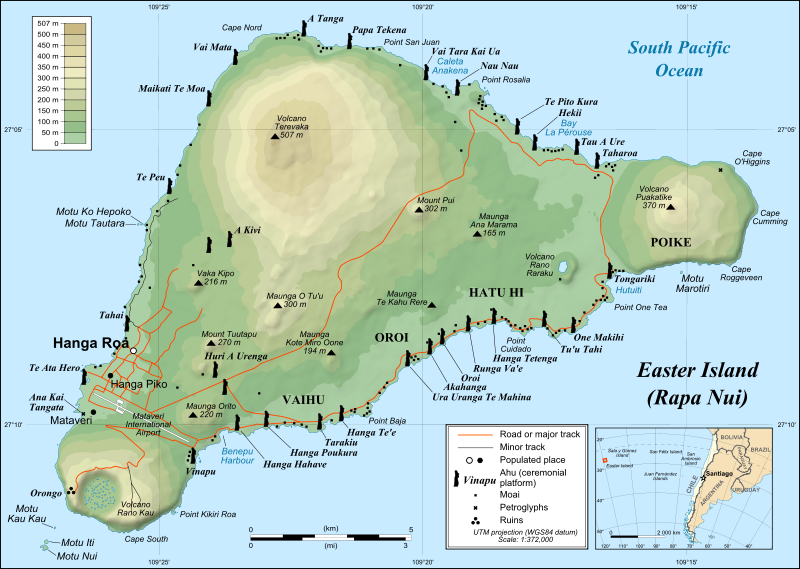
A map of Easter Island/Rapa Nui, showing the three main volcanoes Terevaka, Poike, Rano Kau, as well as Anakena beach, the islets including Motu Nui. Modern Hanga Roa and Mataveri International Airport, the ruins at Orongo and the quarry at Rano Raraku. It marks major ahus with moai.
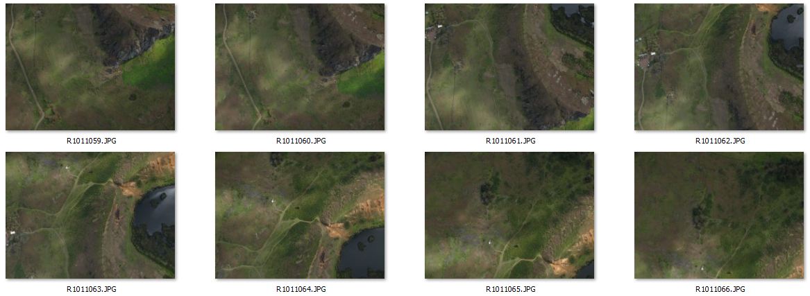
Above we've displayed a small subset of 8 images from the original 140. We recommend obtaining more overlap and imagery for an area of interest (AOI) this size.
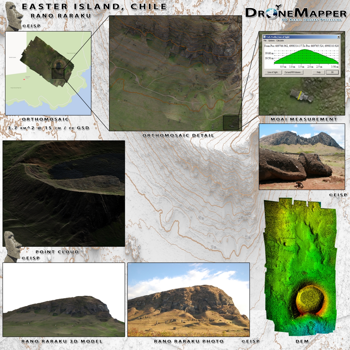
Contact Us for the full geo-referenced downloadable data set.