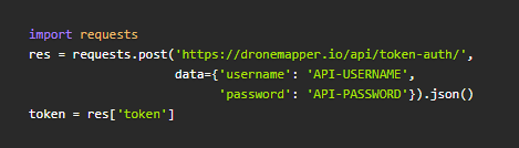
Drone Mapping and Photogrammetry API

drone-mapping-api
DroneMapper Cloud is an API for photogrammetric processing of aerial images. The API allows a developer to programatically interact with our Drone Mapping algorithms to generate georeferenced Digital Elevation Models, Orthomosaic Maps and Point Clouds with or without Ground Control Points (GCP).

API Documentation

Cloud Dashboard and User Interface

The API has an extensive processing dashboard and web based user interface. The UI allows an operator to upload imagery, download processed products, view results in 2D or 3D, make map based GIS measurements (Area, Distance, Slope, Volume) and more.

Request API Access


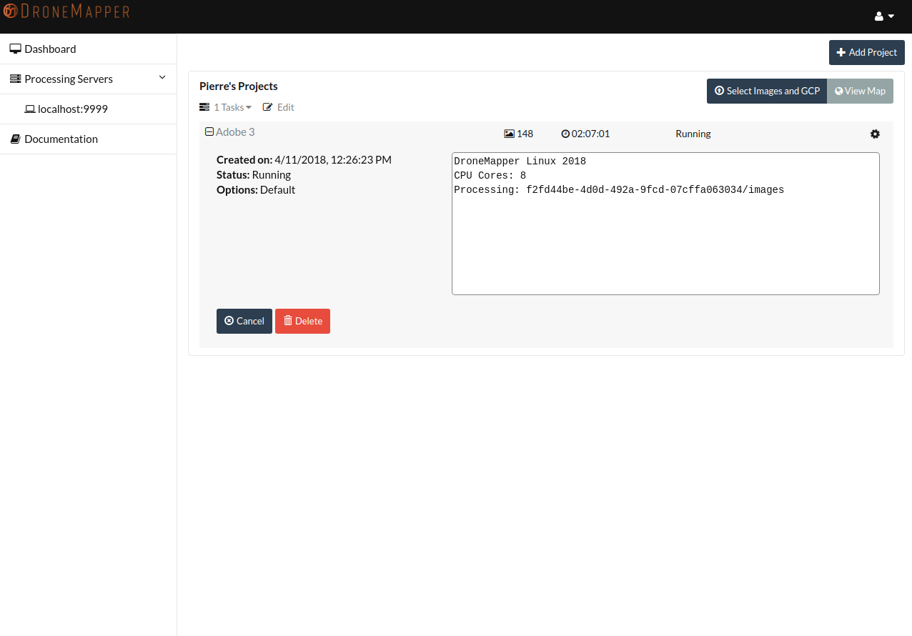
  • Cloud Processing Task Running
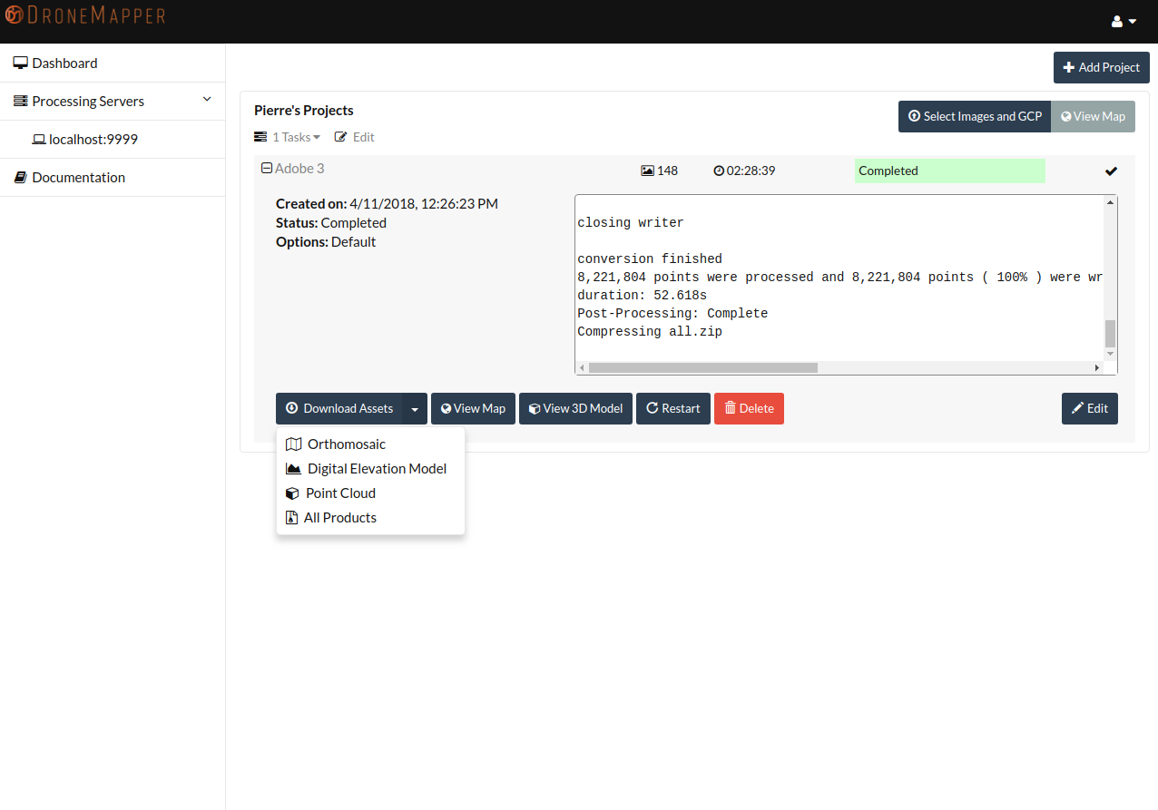
  • Cloud Processing Task Complete
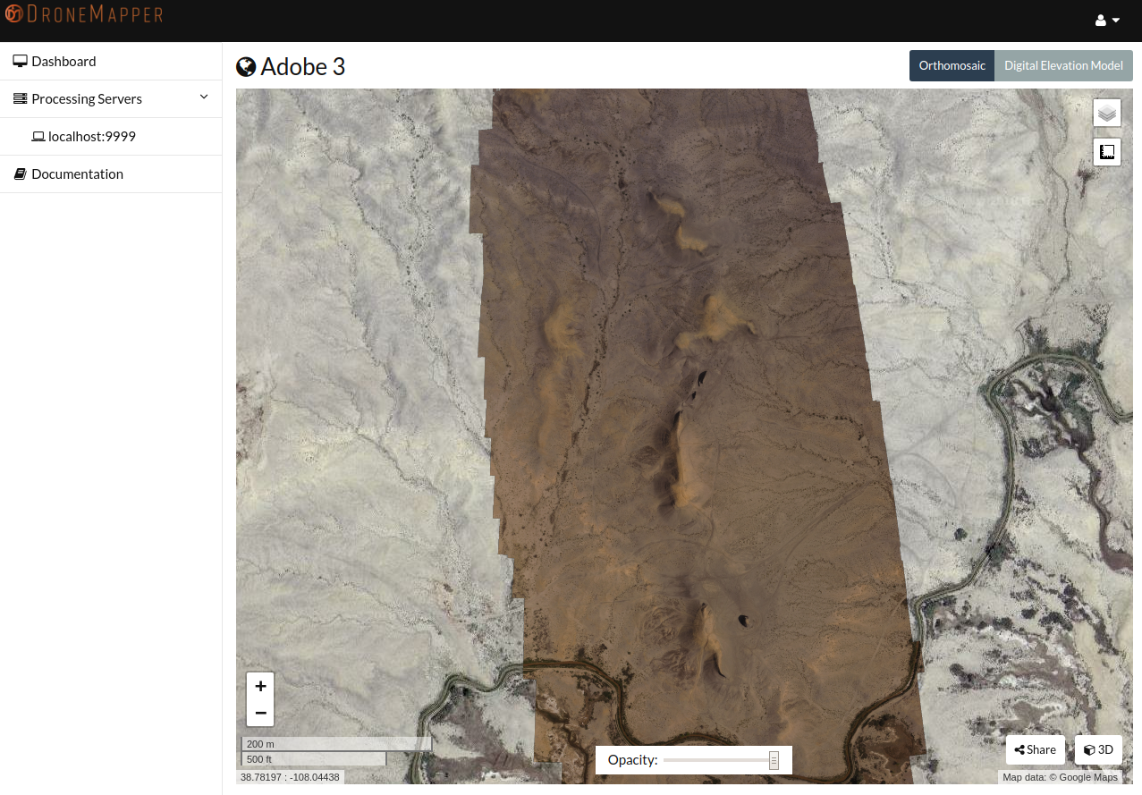
  • 2D Orthomosaic View
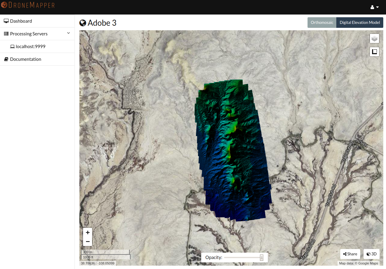
  • 2D Digital Elevation Model View
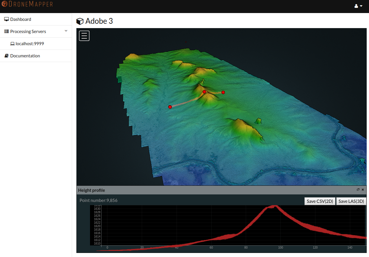
  • 3D Point Cloud with Elevation Profile View
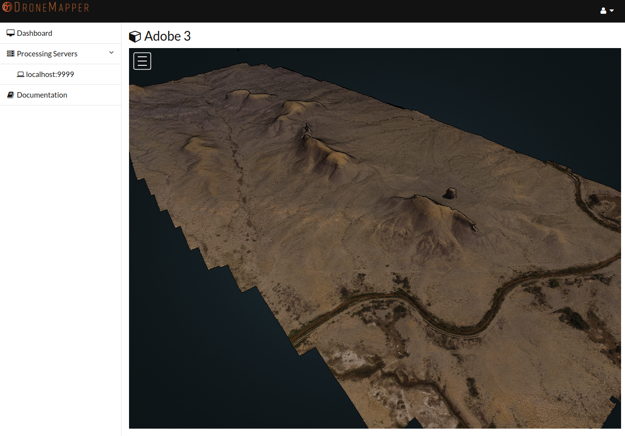
  • 3D RGB Point Cloud View