We’ve made some changes and improvements to the DroneMapper Aerial Imagery Processing service as of 02-21-2014.
- We no longer generate a non-blended geo-referenced Orthomosaic. (OrthoN-DroneMapper.tif)
- Orthomosaic GeoTIFF product has been renamed to Ortho-DroneMapper.tif
- 8 Bit DEM GeoTIFF product has been renamed to DEM8-DroneMapper.tif
- 32 Bit DEM GeoTIFF product has been renamed to DEM32-DroneMapper.tif
- DSM product has been renamed to DSM-DroneMapper.tif
- Low Resolution Point Cloud has been renamed to PointCloud_LR-DroneMapper.ply
- High Resolution Point Cloud has been renamed to PointCloud_HR-DroneMapper.ply
- Altitude Offset is no longer needed during imagery upload. Flight AGL is used instead.
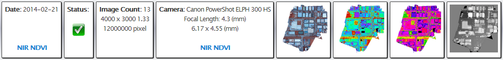
- Geo-Referenced NDVI generation is an option during upload for NIR data collections.
Please contact us if you have any questions or comments!