Photogrammetry Software and Geospatial Services

DroneMapper provides two licensed versions of its desktop photogrammetry software, REMOTE EXPERT and RAPID, as Windows applications. REMOTE EXPERT generates Orthomosaics and DEMs at selectable imagery resolutions processing up to 10,000 images per project. RAPID provides the same functionality as REMOTE EXPERT and is limited to 250 images per project. Both versions are easily licensed either perpetually for REMOTE EXPERT or yearly for RAPID.

precision-ag-tech
stock-pile-volume

Georeferenced Orthomosaic, DEM, DTM, NDVI and Point Cloud Generation

Derived from our photogrammetry products, we provide precision georeferenced contours, orthomosaic planimetrics, accurate volumetrics for stockpiles or reservoir capacity, radiometrically calibrated multi-band vegetation indices, biomass estimation, crop health maps and more.

Precision Agriculture and Enterprise Solutions

Large Areas of Interest (AOIs) can require billions of pixels processed at the highest resolution, and these files can get huge. We handle these big data issues on our cloud servers and provide automated data analytics for extracting and illustrating critical parameters of interest.

dm-ndvi-nir

Photogrammetry Software and Geospatial Services

DroneMapper provides two licensed versions of its desktop photogrammetry software, REMOTE EXPERT and RAPID, as Windows applications. REMOTE EXPERT generates Orthomosaics and DEMs at selectable imagery resolutions processing up to 10,000 images per project. RAPID provides the same functionality as REMOTE EXPERT and is limited to 250 images per project. Both versions are easily licensed either perpetually for REMOTE EXPERT or yearly for RAPID.

Placeholder

Georeferenced Orthomosaic, DEM, DTM, NDVI and Point Cloud Generation

Derived from our photogrammetry products, we provide precision georeferenced contours, orthomosaic planimetrics, accurate volumetrics for stockpiles or reservoir capacity, radiometrically calibrated multi-band vegetation indices, biomass estimation, crop health maps and more.

Placeholder

Precision Agriculture and Enterprise Solutions

Large Areas of Interest (AOIs) can require billions of pixels processed at the highest resolution, and these files can get huge. We handle these big data issues on our cloud servers and provide automated data analytics for extracting and illustrating critical parameters of interest.

Placeholder

Drone Mapping Software, Cloud Processing, AgTech, Flight Operations, Land Survey and GIS Services


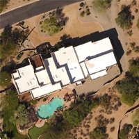
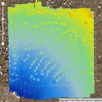
We are an innovative company specializing in photogrammetry and the extraction of value-added products from your imagery. We generate georeferenced Orthomosaics, Digital Elevation Models (DEMs), Digital Terrain Models (DTMs), point clouds, textured mesh 3D models and GIS products for a large set of market segments. We operate a Software as a Service (SaaS) system, provide licensed desktop software, conduct manned and unmanned aerial imagery collections and provide consultation and training specific for your application(s). Please review some of the use cases on the site and feel free to contact us for questions and discussion.


Placeholder

Professional Consulting, Enterprise Solutions, Talk to a Human!


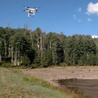
From mission planning to post-processing, an aerial data collection can be difficult to plan and manage – we can help. Please contact us if you need support in finding the optimal flight platform and camera solution for your project. If you need assistance with imagery geo-tagging, data management, flight planning, camera setup, imagery processing, software development or working with your flight controller logs, let us know.


0+
YEARS

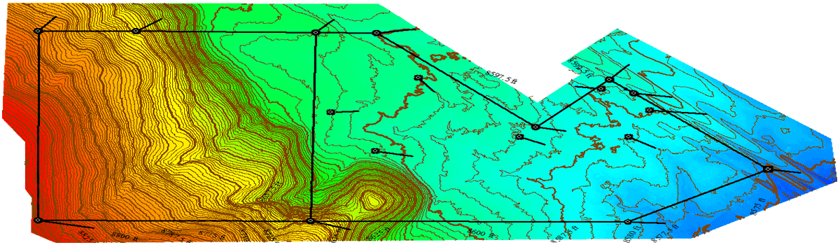
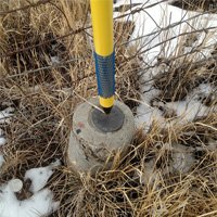
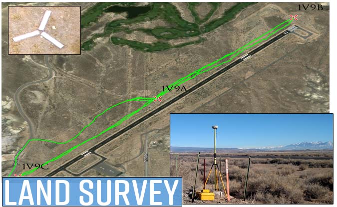
If your project requires tight geospatial accuracy, we can help! Using GPS RTK survey equipment, we typically see near survey grade results with both horizontal and vertical control error less than 1 pixel. Additionally, we’ve developed an aerial ground control point target system emulating a QR code. Our GCP targets are digitally encoded fiducial markers with computer vision software functionality to enhance workflows and provide the highest accuracy possible for photogrammetry missions.

Full Service and Support

Photogrammetry Software


Flight Operations and Planning


Enterprise Solutions


Land Survey and Ground Control


Custom Development


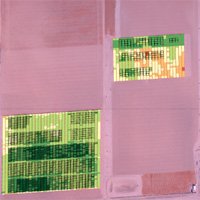
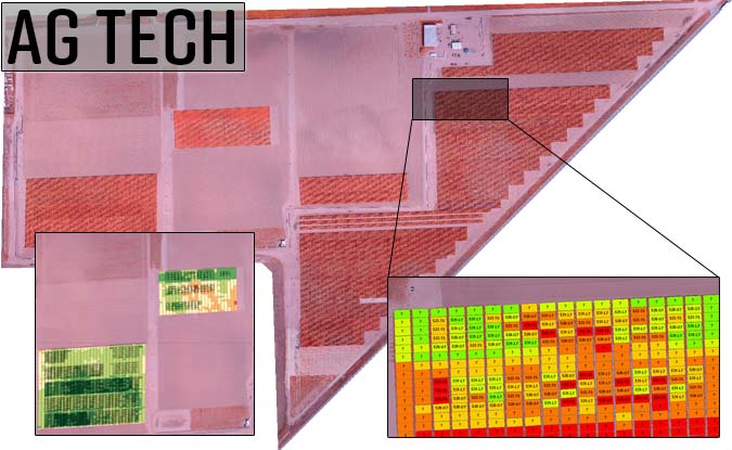
GIS and Geospatial Services


CUSTOMER SERVICE


We make customer service a top priority and respond quickly to our clients needs. You’ll get direct support and work with a human!


EXPERIENCE


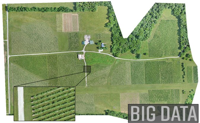
Over the last 7+ years, our cloud processing and desktop photogrammetry software has processed millions of images and acres.


BUSINESS SOLUTIONS


We have developed and deployed numerous business and enterprise wide photogrammetry solutions since 2011. Our software is Linux and Windows compatible.

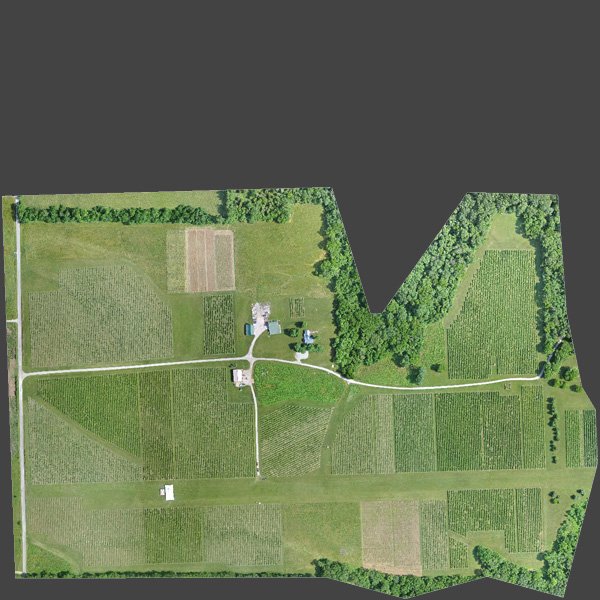
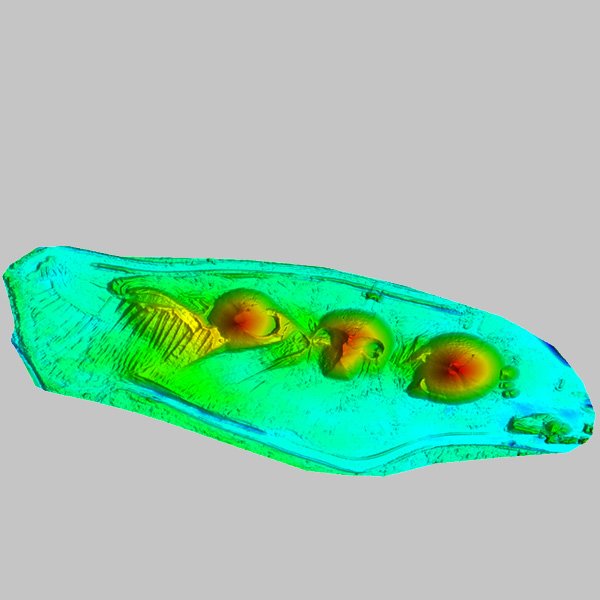
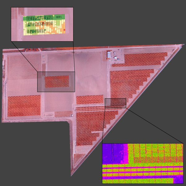
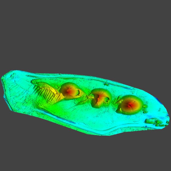
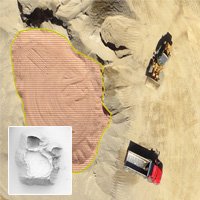
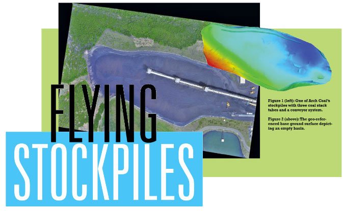
Use Cases and Recent Projects

Placeholder
Placeholder
big-data-drones
dronemapper-agtech
stockpile-volumeland-survey-dronebig-data-dronesdrone-agtech
Contact Us

Questions?
Please give us a call or send us a message using our online contact form.